Day 57 – July 27

So we passed from Wisconsin to Illinois to Indiana today. Our journey around Chicago was long. How long was it? It was so long, we melted away to a shadow of our former selves. Oof. The major highway we wished to take was backed up for 20+ miles. Google cooperated with us today and helped us to navigate away from from the mayhem and into the country side where we passed miles of farms and car dealerships. While we could have rejoiced with its familiarity with Business Rt. 1 in Pennsylvania, instead we cursed fate that took us away from snow capped mountains and roads with s-shaped curves.

And when later we found ourselves in yet another Wyndam chain motel, we beat our chests and cried that we are tired of living in hotels. So what were we to do? We drank vodka and ate Doritos to comfort ourselves. Clearly, we are stuck in purgatory.

Many of you will think that we are nervy and ungrateful. Well we are, dammit. So we will turn down the air conditioning at the Microtel and go to sleep.

The end of a trip is never so exciting as its beginning.

Good night!

Day 55 & 56 – July 25th & 26th

We left Minneapolis this morning and the welcoming home of brother Jeff and Rosemary. What a wonderful time getting reconnected and sharing memories and stories. There’s not a lot to share about our time – the usual family shmoozing and eating and drinking and laughing and crying at remembrances. It was a wonderful gift to stop and share with them. And they are so smart and well read that we have a list of books that need to be read RIGHT NOW. Well, maybe over the next month or so.

Jeff and Rose treated us to a show at the Guthrie Theatre in downtown Minneapolis. We saw “Guys and Dolls” with a fantastic cast including actors from local repertory companies and Broadway. It’s a bit old fashioned for some, but the cast had such energy and skills that they brought the house down. Or brought us out of our seats. Tough to choose the image, but we had such a fabulous time.

Jeff and Rose have a lovely dog named Romi who is a mix of huge Labrador, German short-haired something or other and what looks like wolf. He is big and goofy and loving and goofy and thinks he’s a lap dog. We loved him. Despite our inability to breathe with him nestled in our laps, we loved him so much. And I can assure you we’re carrying a bit of him with us as we travel. (Maybe a pound or so of his fur.) We are full to overflowing love for the family we’ve been with and the remembrance of nephew Joe who died this past January. Sharing was wonderful. Leaving was rough, but it’s time to head home.

We covered about 300 miles today reaching our lodgings outside of Madison, WI, home to the University of Wisconsin. We crossed the Mississippi River at La Crosse and shot east on I-90. Tomorrow we’ll do a bit more with the goal of racing home on Monday. Though if the heat index remains over the boiling point, we may divert to the Atlantic Provinces of Canada. Prince Edward Island maybe. 😀

Curious as to what we would have found if we turned here.

Sorry not many photos. I personally found Wisconsin very beautiful. As we traveled I90, we saw rolling hills and farms everywhere. I believe “bucolic” is the word.

July 22 and 23 – Days 52 and 53

Connie here. Hank is taking a break this evening.

July 22 – Theodore Roosevelt National Grasslands National Park

We stayed in Dickinson, ND so we could visit this park. In 2017, we bypassed it due to fatigue. Well, despite the fatigue, this time we did the loop around the park anyway. This area of North Dakota was considered desolate and inhospitable until ranchers came. Cows, it seems, don’t mind grass mixed with desert scrub and rock.

We took some time to tour the visitors center when we arrived and learned about the different striations in the exposed rock, which you’ll see below. This entire area used to be sea bottom. There are many artifacts in the stone of mussels, alligators and dinosaurs. Who would have thought. As a consequence, much of the rock is compressed sand; hence the sand color. There are also layers of a type of coal called lignite. Lignite is a low rank coal and is not used for energy. But it does burn. There is evidence that lightening strikes have set this layer of rock on fire. In the park, there is evidence of a long burning fire (1951-1977!). Another layer of rock, called clinker, is colored red after lignite is burned underground. It’s truly a beautiful color. There is also bluish grey layer of rock, which is formed from ash from long ago eruptions of volcanos. It’s really amazing.

The park is also a preserve for bison, wild horses, long horned sheep and many prairie dog towns. We caught a glimpse of a bison and a bunch of wild horses. And we were mesmerized by the prairie dogs. They seems to be observing the park visitors as intently as we were observing them.

July 23 – A long trip across the state of North Dakota to Fargo.

Today, we traveled 281 miles from Dickinson to Fargo along razor straight I-94. Thanks to the residents of ND adding roadside attractions to this long trip. We visited a couple of steel sculptures on the “Enchanted Highway” (pictures below).

We saw New Salem Sue – a huge Holstein Cow model in New Salem of course. There, we met a nice family from Iowa (Josh, Trish, Wes and Nick). I joked that they must see lots of cows at home. They responded: no, just corn. Josh was very kind to take our photo in front of “Sue.” We also saw the world’s tallest Sand Crane and Bison along the highway.

Later we met Rick. A heck of a nice guy who recently retired and is aching to take a cross country motorcycle trip with his wife who will retire next year. We had such a nice time talking with him. It was hard to break away.

Otherwise, the roadside was marked with hundreds of miles of green fields: corn, alfalfa and other very green plants. A lot of hard working folks put in thousands of hours a year to put food on our tables.

We got to our hotel and settled in for a relaxing evening only to get a call from the front desk. Our bike was lying on its side in the parking lot. We aren’t sure it there is any structural damage aside from the cosmetic. This is quite distressing to say the least. As of this moment we are waiting to hear from the hotel manager in response to our request to see the surveillance footage. Tomorrow morning we’ll have a local motorcycle shop take a look at her. Note: it’s really uncommon for bikes to all kickstand down.

Oh well, there are worse things in life for sure. Working on attitude adjustment now. 🥃

Leaving you with a little ha-ha. If ever in Fargo, ND, be sure to visit the UFO serving pizza and burgers on 45 Ave W.

Day 51 – July 21st

Long long long long day. 448 miles over 9-1/2 hours. I blame it on hubris.

We left Billings this morning looking to get to Dickinson, ND this evening. A straight shot along I-94 would take us about 6 hours. But no, we thought it would be so nice to take a couple of secondary roads to enhance our riding experience though it might cost us an additional hour or two. To get to the roads we thought we’d want, we headed out I-90 East (becomes NY State Thruway, to give a bit of reference. What could possibly go wrong?

Well, we could miss our turn-off, for one. And we sailed along, happy as clams until we realized our mistake around the time we reached the Wyoming border. Uh, oh. By this time it was almost noon and we were farther away from Dickinson than when we started. The best way to get there involved retracing our route north and then cutting a corner to I-94by using MT 49. No problem, no? Oh, boy.

We made the u-turn and rode the 1-1/2 hours back. Stopped for some fuel (human and cycle both) and headed up Rt 49. About 7 miles in we hit construction: 21 miles of hard pack and loose gravel, mixed well with over-sized RV’s at 10 mph. Oh, well. Slow and not fun, but okay.

We reached I-94 at last and high-tailed it east toward ND. Found the bike likes 85 mph sustained just fine, though mileage suffers some. Great bike for 2-up and heavy. We gave up thinking of our butts and kept at it.

We had a few laughs and a couple of “huh’s”.

At Crow Agency, MT, we stopped in for a cold soda and saw a white clapboard church and a casino on the same property. The casino was closed, but so was the church. This was about 11:30 this morning. Two things that don’t seem to go together. We wonder at the story behind this.

There’s an exit for a town/burg called Diamond Ring. Really. We wondered what that represented. A bait and switch to a frontier bride? As in, I have a beautiful ring for you, it’s just over the hill past that mountain range. We got 30 miles of fun with that. Turns out it’s a ranch near Miles City, MT that reputedly has great Angus cattle. Our made up story could still work.

Then there’s the sign for Home On the Range. Of course you have to start humming along. While there is no town by that name, the website “Visit Montana” tells us the there are 5 dude ranches located in eastern Montana that combined offer home on the range experiences that include every modern comfort. Amid the frolics of deer and antelope. I have to confess that we were pretty tired by then and our imaginings verged on the silly. Or were silly. I relate this with full apologies to the good folks who really appreciate visiting ranches. (. With frolicsome deer and antelope.)

It occurred to us today that re-entered Montana 3 times this trip: once in Cooke City after the Beartooth Scenic Highway, once leaving Victor, ID on our way by the Grand Tetons to Lolo Pass, and finally returning to the States from Canada. We realize that this state is one of our favorites to visit.

So, with fun sights and some beautiful scenery at 80+ mph we managed to have a little fun, and arrived in Dickinson at 6:30. We had some dinner and checked into our motel for the night.

Tomorrow it will be the Theodore Roosevelt National Grasslands, which we passed through just before Dickinson. But now for an adult beverage and a shower.

Beautiful green hills

Some things are incongruous

Oof! Not the ride we expected

Intriguing storm front

“Home, Home on the Range”

A lot of straight roads with interesting geology. More of that tomorrow, we’re sure.

Day 50 – July 20th

We had a fun, long, pretty 330 mile day today. We left Helena, Montana’s Capital, this morning on the way to Billings, a pretty town that is home to Montana State University. Our round about route took us down US 287 to US 12 East, which in turn hooked up with US 89. Gorgeous riding. If you are ever out west and want a beautiful ride or drive, US Rts 12 & 89 will work almost anywhere you are. They are spectacular roads.

Anyway, we stopped for lunch in White Sulphur Springs and ate at the Branding Iron Café, a little eatery that is very popular with the local folks. We had a great meal that included locally prepared bacon and French toast to die for. While there, we met some neat folks. (Of course we did.). A couple, Dick and Janice, are mostly retired and ride their Honda Goldwing as often as they can. Residents of Helena, they suggested about 50 nice roads we should take on our way to Billings. (Well, maybe only a dozen.) We settled on one route that added about 2 hours and 100 miles to the day. Their recommendation was right on. More in a minute. Dick, we will most certainly call when we pass this way again!

Another wonderful woman was Geralita (her mother liked unique names) who is a nurse/care manager at a hospital near her home in Idaho. She got her training as a nurse some years ago and has used it as a stepping stone to some neat jobs. She was back in the area to meet up with her family and stopped for a meal. We’re so glad to have met all three.

White Sulphur Springs is well named with hot springs ready at hand for relaxing. Judging from the number of hotels, it is a popular place to get away. The aroma kind of gave away that natural hot springs were close by.

We took US 89 north for a ways to through a portion of the Lewis and Clark National Forest and turned east on a local road, MT Rt 427. Gorgeous land. We stopped for a minute and found ourselves under the scrutiny of a very large Angus bull. Connie got a pic. He was grazing near the foundation of a burned out farm house. Though there was a fence between the bull and our rest spot, it didn’t look all that solid to me. Fortunately, he lost interest after a while. Very glad were we.

Rt 427 took us into Raynesford Where we turned east on US 87. Riding through Geyser and Moccasin and Eddies Corner where we turned south on MT Rt 191. Rt 191 took us through Buffalo and Judith Gap to US 12 again at Harlowton. We turned east once more and rode to Lavina, where we headed south on Rt 3 into Billings. Very fun riding with so little traffic it’s beyond belief. And the land is unusually lush because of recent rains. We passed so many pastures with cattle and horses. To meet the need for food, so many fields are cultivated with hay and alfalfa. It’s hard to convey the scale of farms and ranching out here. Small ranches cover a mile or more. Larger farms go on for 5 or 10 miles or more. Feed grasses are baked in large, six foot rolls that are trucked to farms and feed lots throughout Montana. On a number of farms, these rolls were scattered by the thousands for as far as the eye could see. Connie got a fair picture of that, too. Back East, we just don’t appreciate how big the agricultural system that brings us our food really is. Or how much work goes into a farm. Or how thoroughly we depend on these folks to supply the food that’s on the shelves and coolers at Wegmans. And this is one small-ish part of the farm system that feeds us every day.

Anyway, we had such a good time today. Now we’re comfortably ensconced in our room and about to set to our meal. A nice shower and an adult beverage have gone down well. By the way: we have ridden through 80F weather for the first time in a month. Promise not to whine too much. 😀 Tomorrow we’re off to Dickinson, ND.

Big Snow Fences

A Prairie Day

Clusters of Hay Bales. There were miles of fields full of them. The ranchers are getting ready for winter.

We’ve came across fields of pink flowers for a few days now

More time on the prairie.

We love our bike and I love it’s rider.

Tenacity of life

Days 48 & 49 – July 18th & 19th

Thursday, the 18th

We woke up this morning in this adorable apartment in the picturesque town of East Glacier ready to rock and roll. Until we got the skinny on the weather, that is: cloudy, rainy, low 50’s and windy – 30 mile sustained with gusts to 50 mph. After a couple cups of coffee, we decided discretion is the better part of valor and laid low. When we took a stroll to get some lunch, we saw a bunch of bikes crawl by whose drivers looked drowned and unhappy. All except one: Lisa.

We met Lisa Henne, from central Pennsylvania, while eating in the little café attached to the general store. She is a mom to seven kids (mostly grown), grandmom, wife, surgical tech to a dermatological surgery practice, and motorcycle rider. She is riding alone because her husband couldn’t join her this outing. Something about a new foal. She has been on the road a couple of weeks and will continue her ride through much of August, hoping to touch as many states as possible. And she camps – all her gear is loaded on her 750 cc Honda. We shared stories and tips for a good long time while she dried out and warmed up after a cold rain storm. Fortunately she didn’t have far to travel today. Her attitude toward life and work and vacation very much put us in mind of our Tina in Cortland. She impressed us so much with her ambitions and positive attitude and she’s now one of our heroes. We’re hoping she has a great, safe rest of her trip.

East Glacier is a neat little town at the intersection of US Rt 2 and Montana Rt 49. There’s an Amtrak station there that brings folks close to Glacier National Park and vacation. (From the inception of the National Park System, railroads have played a big part in bringing people to enjoy the parks.) Two Medicine Lake, part of Glacier, is just a few miles up Rt 49 and so gorgeous. (Have we mentioned that we feel so blessed to have our National Park System?) 😀 The folks here are friendly and helpful in that way of small towns across the country: people will smile and say hello on the street, and are happy to share some conversation and helpful suggestions. Beats a good morning snarl, for sure.

Our hosts. Barbara and Christine, are relocated easterners who truly love their adoptive Montana home. They earnestly suggest that we might like it, too. Their only recommendation is that we make sure to try out a winter in Montana (minus 50* for weeks at a time, about 20 feet of snow, closed roads, so forth.) before buying. Sounds like heaven, to be sure. Makes me wonder how many bodies are found in melting snow banks after months of close confinement. Hmmmm. That plus distance from family gives us pause. But there is some appeal here.

Friday, the 19th

Today is our last day in the Rockies. We’ve been in the mountains for more than a month and are very sorry to leave. From Colorado Springs on June 7th to Jasper, BC to East Glacier, MT, we have been entranced. It’s been a dream come true. But it’s time to move on.

Although the wind was still substantial today, we made a quick jaunt to see Two Medicine Lake and a fun loop along the eastern edge of the mountains. Our destination today was Helena, MT, thus making our way into the Great Plains and the first stage on our road home.

We covered over 220 miles today and there was a lot of buffeting (wind) along the way. We’re ready for an adult beverage, some supper and a night’s rest. Tomorrow we head out to Billings, MT, and hope the wind is a bit less. Now that we’re heading east, home is looking pretty good. Except the heat. We had a high of 66 today.

Two Medicine Lake, Glacier National Park

Good-bye Rockies.

From the mountains to plains in 20 miles

We finished the day in Helena State Forest

Day 47 – July 17th

We had a beautiful riding day today. From our hotel in Browning, MT we headed north on US Rt 89 toward St Mary’s and the east entrance to Glacier National Park. On the way we encountered a small herd of horses in and alongside the road. Seems they got free of their corral or paddock or whatever they hang and were chomping on some tasty grass or bushes or whatever. There was even a foal nursing, which was touching. Though it called for caution, there was no excitement and they appeared as happy as can be. Later in the day, a line of traffic came to a screeching halt as a “free range” bull just sauntered across the road in front of us. Everyone seemed delighted to let him go his way. He couldn’t have cared less what we thought. Just rural Montana traffic. Nothing to get excited about.

St Mary’s Village is located at the north end of St Mary’s Lake, which is in turn fed by St Mary’s River, which contains St Mary’s Falls. (Names around here can be pretty easy to remember.) This little village that boasts 50 year-round residents sits at a strategic spot for exploring the eastern part of Glacier Park. It is really small and really pretty. Two more important characteristics: it sits on the western border of the Blackfeet Reservation, and is the western terminus of the Going-to-the-Sun road through Glacier.

Going-to-the-Sun road is a high, tight and winding road that takes you through stunning mountains, rivers, water falls and even clouds for 53 miles. For bikers, it’s a famous “must ride” that is a little challenging with oh so beautiful spots to dismount and enjoy. Connie and I arrived early so traffic was not heavy and we had lots of opportunities to stop and drink it in.

We had a chance to talk to an Park employee named Tony, who has worked with the Park Service for a number of years. His wife also works for the Park Service. He couldn’t say often enough how much they both love it. They are full-time RV-ers and have started their own side business, Glacier Emblems, making commemorative pins and patches for discerning tourists. He is so enthusiastic about his work and seems to revel in meeting Park visitors. He’s the kind of representative who makes you glad you came.

Going-to-the-Sun empties out close to the western entrance to the park, where we spent a wonderful time with my sister, Judy, in 2017. We stopped at the Lake McDonald Lodge on Lake McDonald for lunch and a cup of coffee. We brought our own food but the coffee was hot and fresh. We saw more lovely mountain scenery and watched an intense stone skipping match involving a bunch of boys and girls. The girls won going away.

We headed out to our lodgings for the night, a cute apartment in East Glacier Village with a view of the park. Tomorrow will be our last day in the Rockies and we’re a bit sad to go, though we’ll be happy to see home again. We’ve been in the Rockies since Colorado Springs on June 7th. We also haven’t had days warmer than about 75F and most much cooler. I’m sure that doesn’t play particularly well right now with the eastern heat wave, but we’ve loved it. We plan to do a little more riding in and around Glacier then get some rest for our push to Minneapolis and family. This has been a wonderful day. Have a great night.

Day 44 – 46 – July 14th to 16th

Sunday, July 14th

Today was a travel day. Mostly. After resting a bit yesterday, we packed up early and rode south to Waterton Park, part of the Canadian National Park System. Our ride took us through some pretty mountain valleys and forest preserves along Rt 1A, Rt. 22, Rtes. 3, 6 and 5 into Waterton Village. The terrain looked a lot like Montana and Wyoming across the border to the south, and there was an abundance of ranch land. We saw so many signs cautioning us that mountain goats, sheep, bears, moose, deer and caribou may cross the road over the next 24 kilometers, or 13 kilometers, so forth. (We even stopped for a trio of mountain goats who stared at us from the yellow lines before reluctantly ceding the macadam.). Add to that the advisory that cattle could be found on the road – “Stock Is Free Range”, and we had to maintain a modest speed to be safe.

We wound up taking a wrong turn (inevitable) onto Rt 3 toward Crowsnest, AB and rode into the lot of the Leitch Collieries for a u-turn. It looked interesting so we got off the bike and investigated. At the turn of the 20th century, a Canadian consortium tried to exploit the coal deposits in the northwest provinces. It was a huge undertaking because development required creating routes in and out of the area for trucks and rail lines to haul cargo. That meant enticing trained and skilled people, artisans, engineers, masons, and miners, to move to this isolated place with a sometimes forbidding climate and build the mines, storage bunkers, coke ovens, rail lines and depots, and all the infrastructure needed to get this industry off the ground. The Leitch Collieries ultimately failed not long after WWI after a number of accidents and a fluctuating commodities market, but not for a lack of will. It’s a fascinating story.

Anyway, we got ourselves turned the right way and scampered into Waterton Village mid-afternoon. It is an adorable town that’s built on Waterton Lake and sees thousands of tourists each year. During peak tourist season (July and August), the full time residents number about 250; by December they number under 50 (very durable) folks. We took a tour boat ride this evening with three of those folks as crew. They have so much to tell and show. The boat is the MV International of US registry and holds up to 160 people. The cruise took us south along the shore to the American end of the lake at Goat Haunt, administered by the National Park Service. The site was closed because the NPS has not received sufficient funding to staff and maintain the camp. (Sad) About midway down the lake, we saw a straight cut through the trees on both sides that marks the Canadian/US border. It’s pretty rugged terrain! We had our eyes peeled for wildlife and were rewarded with a majestic bald eagle surveying his domain from a perch in a tall pine. The cruise is a little pricey, but it was worth it because we learned so much and enjoyed the ride thoroughly.

Waterton Lakes National Park is the northern half of the Waterton-Glacier International Peace Park, created by act of the US Congress and the Canadian Parliament in 1932. Signed into law by President Herbert Hoover and Canadian Prime Minister Richard Bennet, the combined park made sense because both areas included the same mountain range and both have nearly identical biological and ecological systems. Caring for the parks could be cooperatively managed, particularly in the event of emergencies. Like wildfires. Waterton alone has suffered three large wildfires over the past three years, with the Kenow fire in 2017 being particularly bad. The folks we spoke to were very grateful for the resources the US deployed to help Canadian firefighters control that blaze. The Village and some Glacier Park assets were spared because of their combined efforts. Now, two years later, we can still see the destruction to the local forests even as new growth rises.

In 1995, the UN (UNESCO) declared the combined Waterton Glacier International Peace Park a World Heritage site because of its uniquely beautiful environment and biological significance.

After the cruise, we came back to the cute cottage where we stayed and had to pause a moment. There was a doe just outside our front door who clearly felt this was her turf. Mostly she grazed and paid us no never mind. She even allowed us to come fairly close and we got some pics.

After a few minutes we headed back out to stargaze. Waterton Park is also an International Dark Sky Preserve with strict rules limiting night time illumination. The sky is clear and we had some great viewing without leaving town.

One final note: our one frustration with our time in the National Parks of both the US and Canada has been the lack of WiFi/internet service. That has made our data-intensive posts very difficult to upload. When you’re able to read this, please know we’re late not for lack of trying. Your reads and comments are so rewarding. We thank you, friends!

Monday, July 15th

Today we had a great time just wandering around this pretty little village, enjoying the sun, the kitschy shops and a breezy (30 mph) lakeshore stroll. We ate VERY well and kept on rolling. Eating is pretty expensive here: a large drip coffee is $3.00 Canadian ($2.25 US) and a delicious plate of ribs is $40.00 Canadian ($30.00 US). You get the picture. If you’re going to stay here for more than a couple of days, you definitely want to shop for groceries outside the park and tote them in. (But you have to try the ribs or the brisket – they are fabulous!)

No riding today. Just relaxation, eating fattening food and a good night’s sleep.

Tuesday, July 16th

This morning we left Canada and entered the US at Chief Mountain Port of Entry. It was nice to re-enter the States, though we found the surly attitude of the US border officers disappointing. Even with Global Entry passes (passports, too) it was clear we were an inconvenience to be endured and dismissed. There is a place for efficiency, for sure; but rudeness, no. Particularly from the very first people a guest meets when entering our country. And there was no line of cars waiting. I hope it was just a bad day.

We rode through the eastern part of Glacier National Park and enjoyed our ride. We stopped at one of those roadside attractions that promises great authentic Blackfeet Tribe souvenirs, weekly bull riding and good eats. There was a portable taco stand called “Wandering Gringos”. They were quite busy, which is amazing since only a few cars pass along the road every few minutes. So we had to try it. We split a “burrito supremo” with all the fixings for $10.50 plus tax. When it came out, it weighed at least a pound-and-a-half. It was fabulous! Not only tasty but in the way it “sticks to your ribs.” My ribs are still plastered with this gustatory extravaganza. We ate at 1:30 and it’s now 8:30 – hunger is not in my vocabulary.

Tomorrow, we will ride the Going to the Sun Road through Glacier. It’s one of the iconic motorcycle rides in the US. So, a Brioschi and then to bed because tomorrow we ride.

Evening Cruise at Lake Waterton

Sunset in Lake Waterton

International Peace Park: Waterton Glacier

Evidence of a Massive Fire in Waterton Park in 2017

Beautiful Scenery and Lovely Walks

Hanging Out on the Iconic Red Adirondack Chairs

Traveling Back Into the USA to … Montana (this is the 3rd time we visited Montana on this trip!)

Mountains to Prairie and Back Again

A Roadside Food Truck Selling Mexican Food: The Wandering Gringo!

Day 41 to 43 – July 11th to 14

Sorry for the delays. WIFI is not as available.

Thursday the 11th

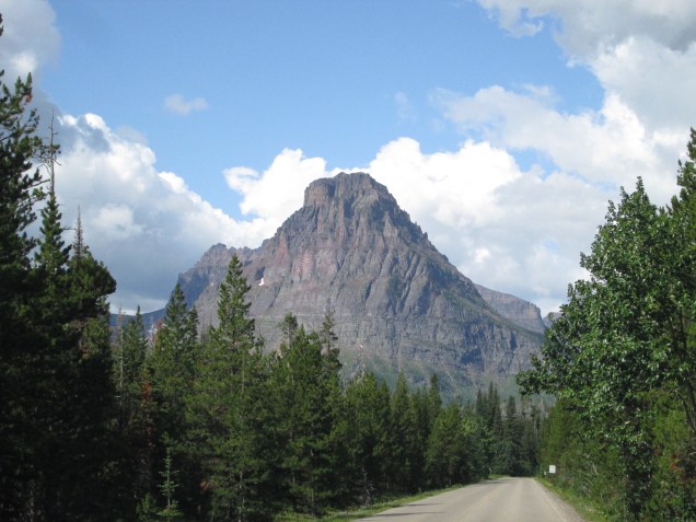
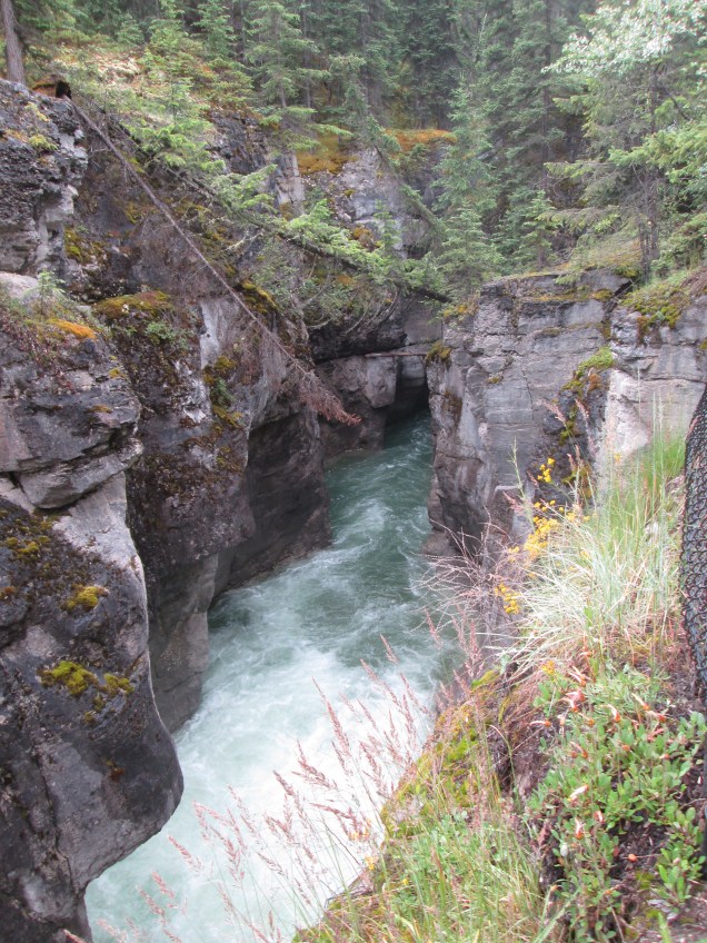
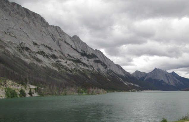
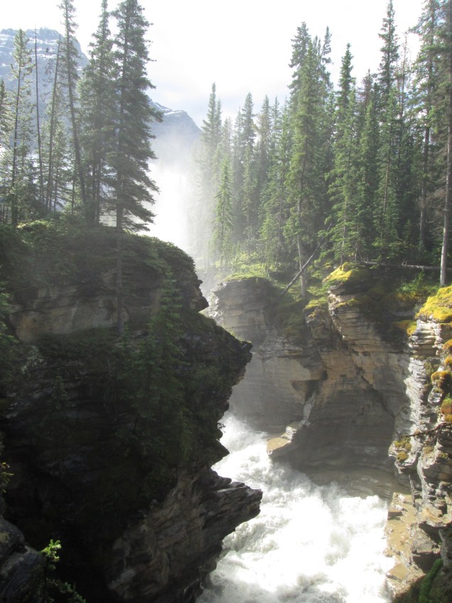
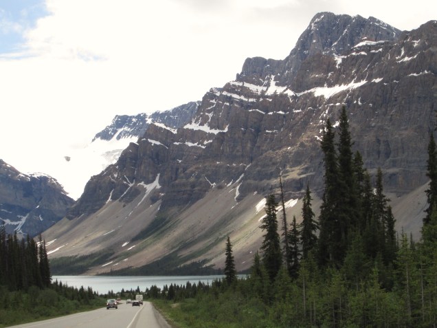
We got an early start this morning and left Jasper, AB, for the Icefields Parkway, (Rt 93 South) toward Lake Louise. The parkway reaches 282 kilometers to Lake Louise, about 2-1/2 hours as a straight shot along the route of the Continental Divide. Of course we couldn’t do that. We stopped at the Athabasca Falls which is fed by runoff from the glacier of the same name. Unlike most rivers flowing from the Continental Divide, the Athabasca River flows north, not east or west, ultimately joining with other rivers to reach the Arctic Ocean at Inuvik in the Northwest Territories almost 2,000 miles away.

The water is milky white, a suspension resulting from rock being ground to fine powder under a glaciers immense weight. This powder, sometimes called glacier flour, infuses huge quantities of water from glacier melt off. While there, we met up with a tour group composed of Old Order Mennonites. Not some thing we’ve seen often.

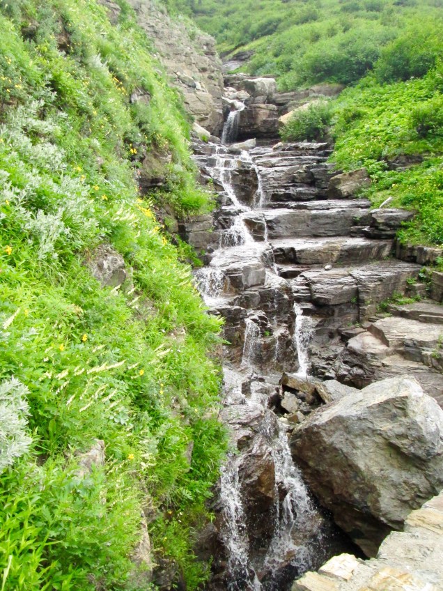
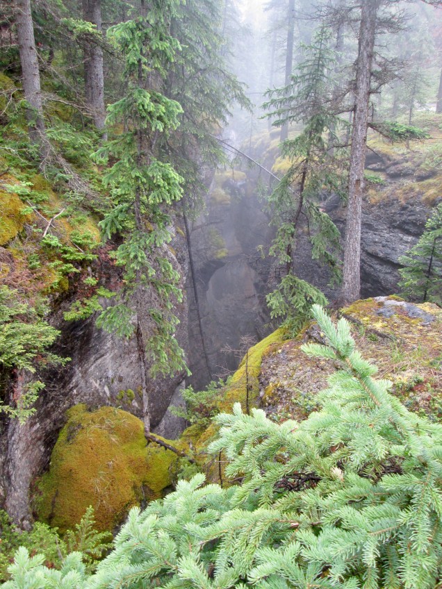
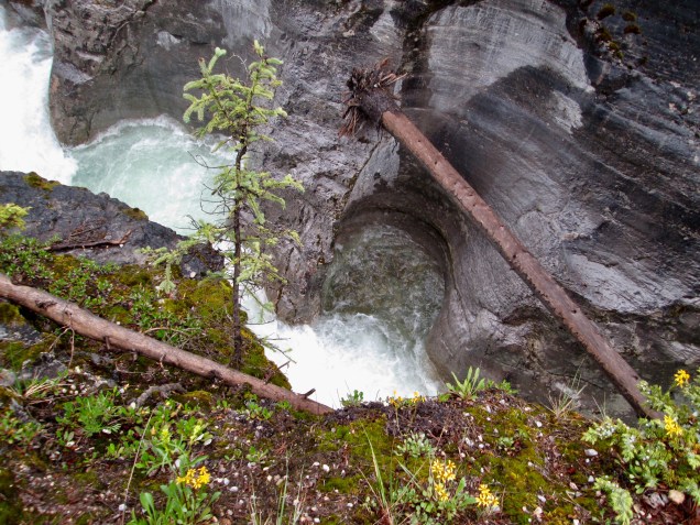
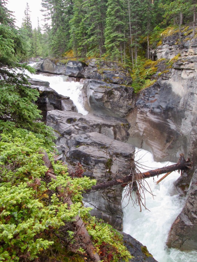
Our next stop was Sunwapta Falls, which roars through a deep gorge that has been cut over tens of thousands of years. This water was clearer having less glacier flour.

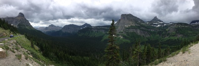
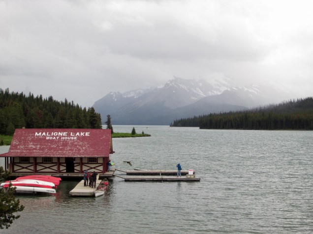
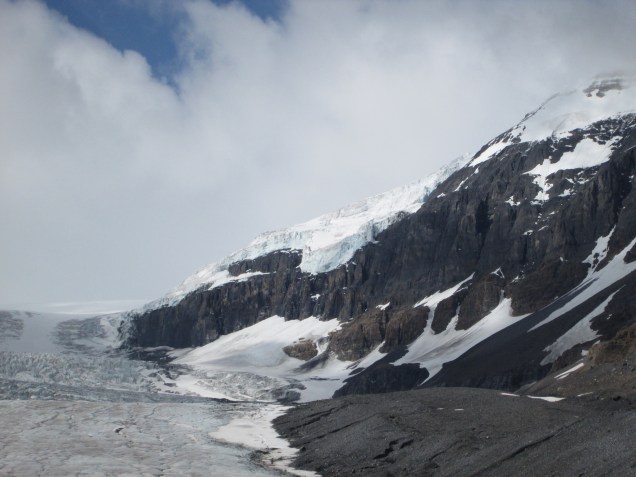
The Columbia Icefield, about half-way down the Parkway, is a collection of glaciers to the east of Mt. Columbia. Several glaciers are on prominent display, including the glacier from Mt. Athabasca. The glaciers have been receding for many years. We parked several hundred yards closer than its farthest known progress as of 1908, and then hiked for a kilometer in past multiple markers that show its retreat up through today. One marker denoting it’s reach as of 1982 is almost 400 yards from the present glacier’s edge.

The environment below a glacier is stark, rocky and quite raw. The wind off glaciers is called “katabatic” wind and is very strong and very cold. All those millions of tons of ice cool the air above it quickly, and because cold air is denser than warmer air, the air streams down and off the glacier at a great rate. Though the ambient temperature outside the park was around 55*F, the wind off the ice was close to freezing. So folks who were hiking wearing jackets appeared happy to move briskly. Those with shorts were not so happy and just plain ran. We found the hike interesting and severely beautiful. Of course we were dressed still in our riding gear and long John’s and extra socks.

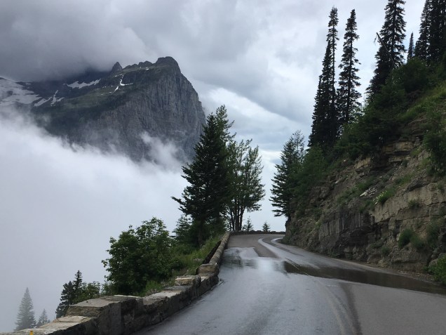
We ultimately stopped at a dozen or more turnouts to see the sights. Waterfalls are a constant temptation and we indulged early and often regardless of size.

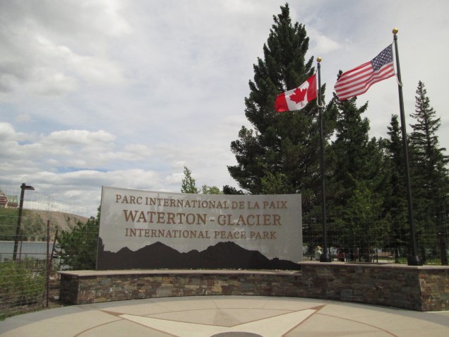
By afternoon we passed out of Jasper Nat’l Park into Banff Nat’l Park. We felt we were close to being done for the day and arrived at our hotel in Lake Louise Village to rest up. Unfortunately my brother and sister-in-law, Jeff and Rose, could not make it as we had hoped. Something unexpected came up so they had to cancel. They are wonderful company and we will miss our time together very much.

Friday the 12th

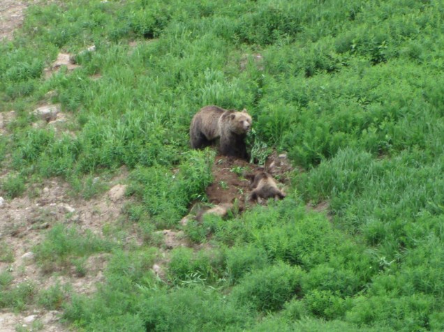
At 6:30 this morning we caught a shuttle to the Lake Louise Ski Area to take a gondola to near the top of the mountain to see what we could see. (This came highly recommended.) It was awesome! Connie had snagged our tickets in advance so we made our way to the lift, which took us up beautiful scenery and a mother grizzly and her cubs. Up and down the line, everyone was excitedly calling out to each other and taking pictures of the trio. It should be noted that the stars of the show acted as though they couldn’t care less. They were busy chowing down on some vegetation, the cubs were wrestling and playing like youngsters do. It was a bit unreal as well: we humans, members of the dominant species on earth, were thrilled and happy to see these apex predators of the Canadian Rockies, but only because we were viewing from a safe height. The matter would be somewhat changed if we’re were on even ground. Interesting.

We unloaded up top and were treated to more awesomeness as Lake Louise and its surrounding mountains were laid out before us. The highest peak is Mt. Temple at the center of a row of majestic peaks and glaciers. We walked a bit then had something to eat on the outdoor terrace of the mountainside restaurant. A bit pricey, but a worthwhile extravagance. While up there we saw the same grizzly and cubs down slope a ways, on the other side of an electric fence. Bears are taken seriously here. On the way down we were lucky enough to see another mother grizzly with two cubs. Amazing!

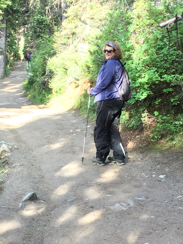
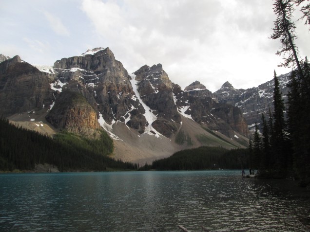
We got back to our room at the Mountaineer Lodge in town by mid-afternoon and rested for a couple of hours. Then after our sumptuous repast of bagged salad and assorted sides we got on the bike and headed to Lake Moraine for a walk along the shore trail. We arrived around 7:00 pm after the crowds had dispersed.

That’s a real issue in Banff Park. Because it’s so popular, there can be substantial crowds during the day and parking can be an issue. Using the shuttles or arriving very early or late helps. For us, riding on a bike makes parking much easier, though we try to avoid peak times.

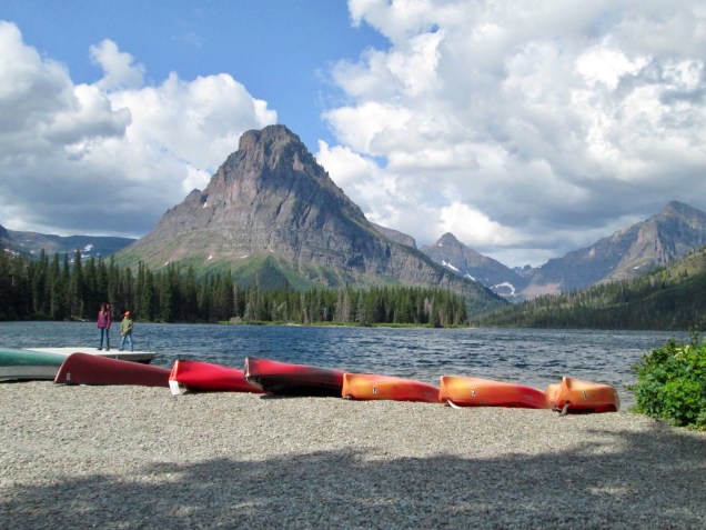
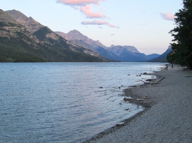
Lake Moraine is a glacially fed lake located in the Valley of Ten Peaks. The lake is cupped by this ring of mountains and it is so beautiful. There are a couple of small glaciers up high, and a lot of evidence of ice and rock avalanches. We spent nearly three hours walking and gawking and taking pictures until sunset (10 pm) moved us to ride back. We think Lake Moraine is more beautiful than its famous cousin, Lake Louise. Just saying.

Saturday the 13th

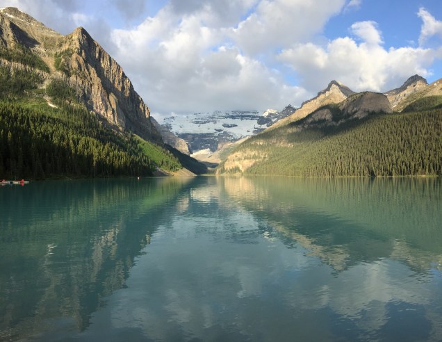
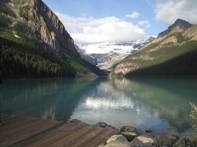
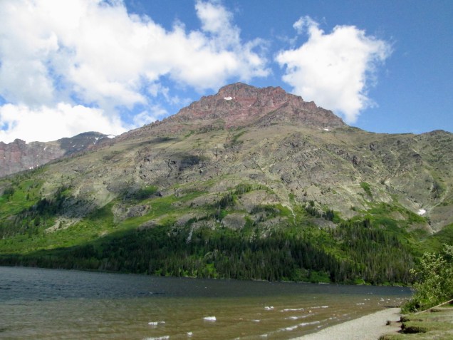
We got ourselves launched early again and rode to Lake Louise. Though we were on our way by 6:30 (before coffee, I might add) and we were about 900th in line to get into the parking lot. There were bike spots laid out so it worked quite well. We brought coffee and a nosh from our hotel and quickly ate, which both improved our frame of mind and opened our eyes fully. The canoe rental shop had just opened and there were a couple of boats making their way to the far end of the lake. The water was very still allowing the mountains’ reflection to show clear. It was beautiful! We hiked a bit on the east side and treated ourselves to about a hundred more shots. We just don’t tire of snow covered peaks.

That’s how we spent our day until the afternoon. By then we were a bit worn out and decided to rest up before our long ride tomorrow. There are so many other places we would have loved to see here in Banff, like Peyto Lake, Bow Lake, Thompson Canyon. Those will have to be stops on our next trip here.

Now, we hope this uploads. Here’s to mountain WiFi.

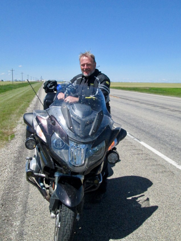
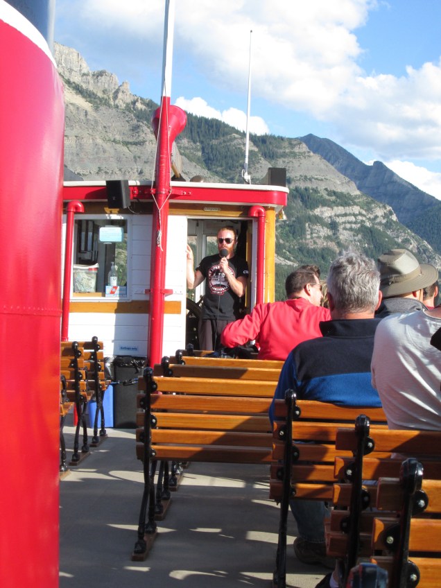
Morning safety check

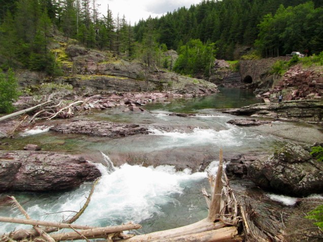
Abathasca Falls, Jasper National Park

Abathasca Glacier, Jasper National Park

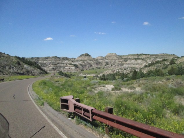
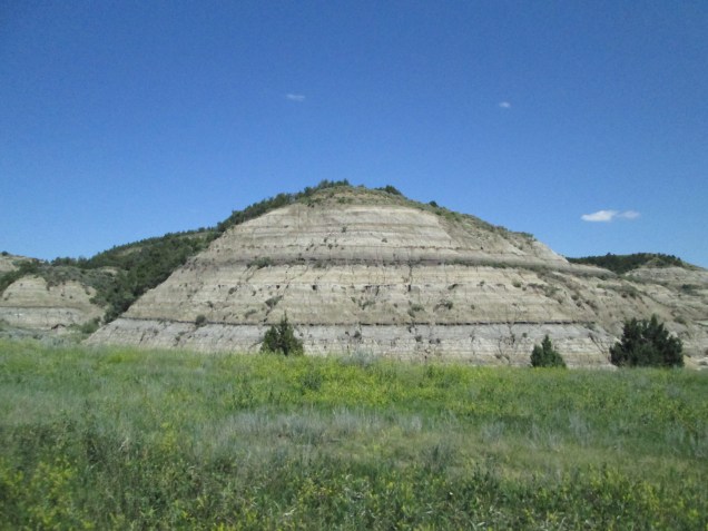
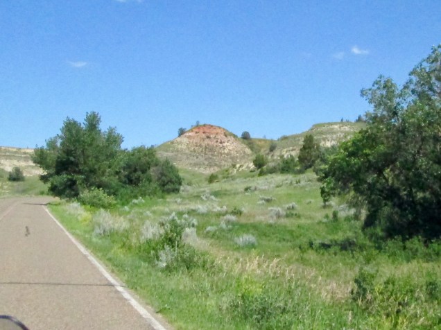
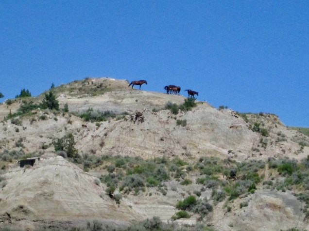
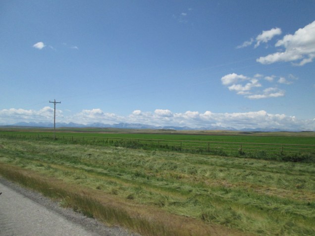
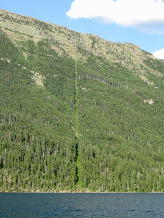
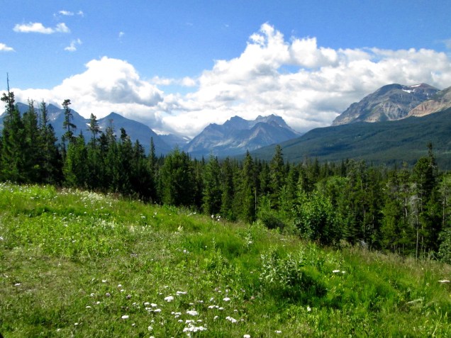
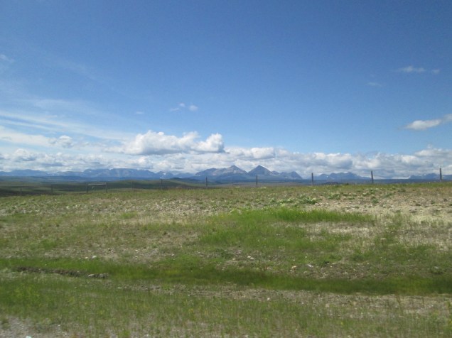
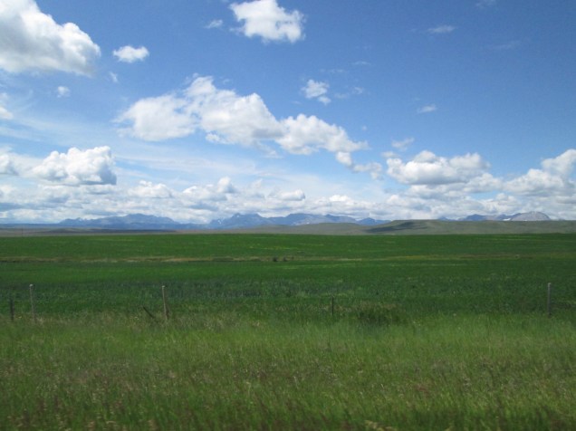
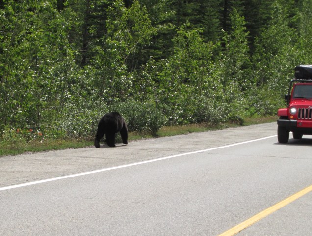
Beautiful views along our way. And a bear on the roadside.
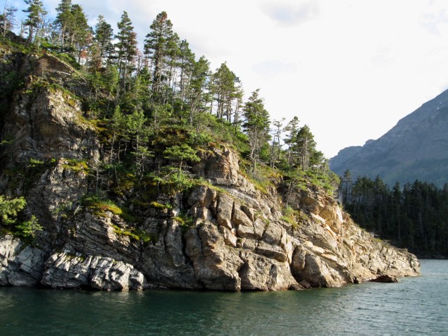
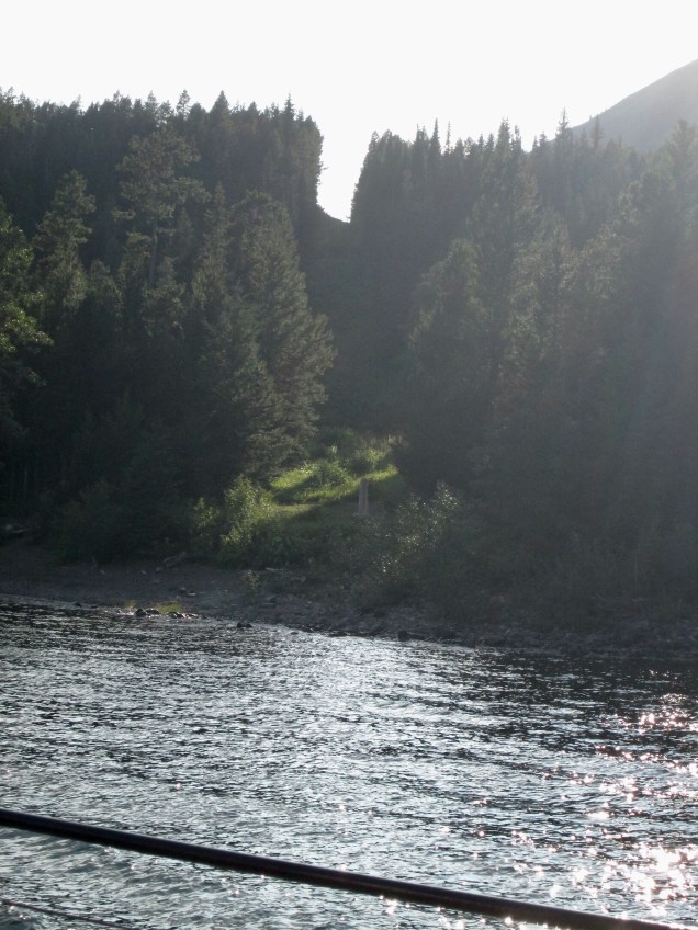
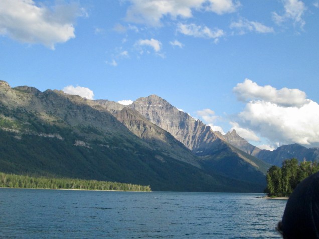
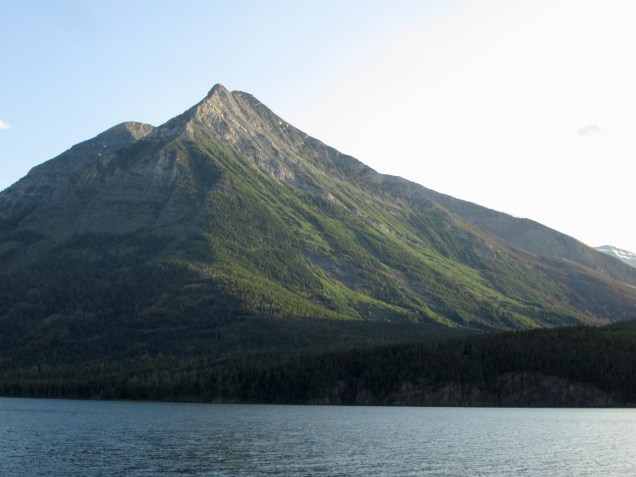
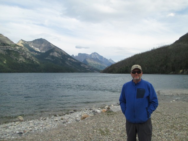
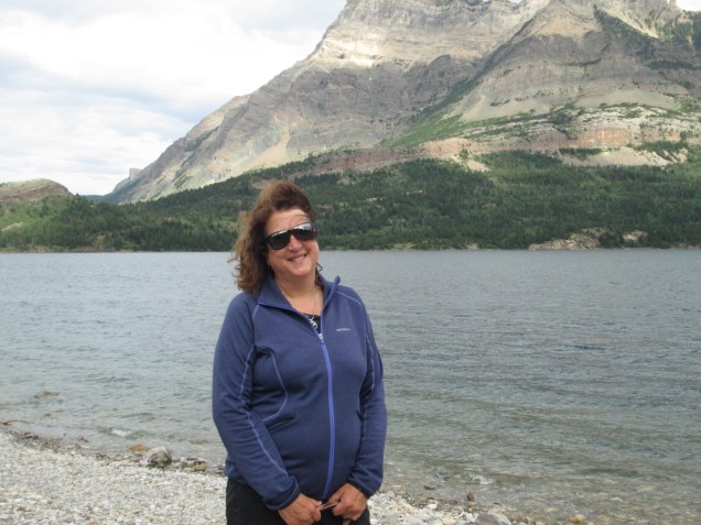
Banff National Park

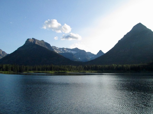
Gondola Ride Overlooking Lake Louise, Banff National Park

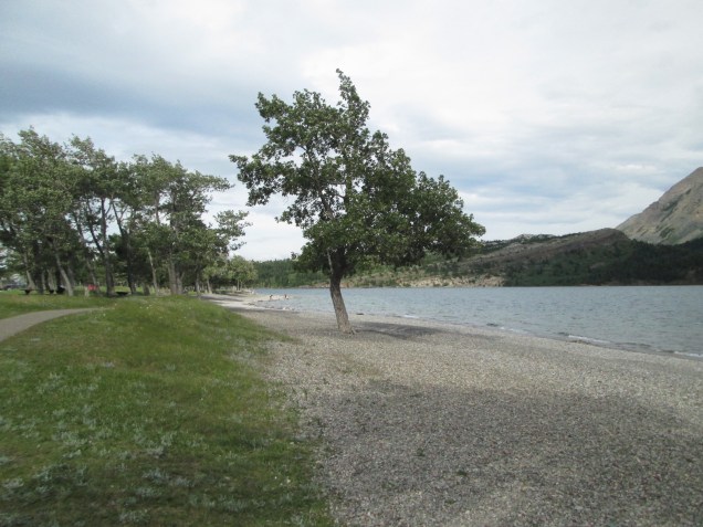
Moraine Lake in the evening, Banff National Park

Hiking Around Lake Louise, Banff National Park

Day 40 – July 10

40 days and 40 nights…

Today was our last full day in Jasper, AB, and we continued our leisurely pace by lounging until 8:30. We had breakfast with Mike from Chicago (still didn’t get his last name!) and saw him off to Prince George, BC on his way to the AlCan Highway and Alaska. For our part, we set off for Maligne Lake within Jasper Nat’l Park. It’s another one of those trips that looks brief but isn’t. According to Google Maps, it is 47 kms, about 28 miles, which might take an hour. That prediction does not include stops for pictures, stops for caribou, so forth. In fact, we spent almost 4 hours heading into the park though the delays were mostly self inflicted. We had the pleasure of sharing the road in with a trio of young caribou who couldn’t seem to decide which side to take.

The road we were following, predictably called Maligne Lake Road, took us by some gorgeous lakes and streams, including the Abathasca River, and the Maligne River that connects a couple of lakes in the north park. The Maligne River got its name from a French Jesuit explorer who thought the trouble the river gave him was wicked or evil: hence the name “Maligne”. The Maligne River has cut its was through bedrock to make a steep, narrow Canyon we reached by a nicely laid out trail. The river then goes underground before emptying into Medicine Lake. The view of the rushing water snarling through the narrow defile dozens of feet below is so striking. At one point, we saw a heart-shaped rock the size of a VW Bug wedged between the lips of the narrow canyon. Yes, Connie got the pic.

We climbed back on Shiny and rode by Medicine Lake, which has a number of islands near its eastern shore that host bald eagle nests. (They look more like airborne condominiums than nests, but I digress.) We didn’t get a pic of the adolescents (they did not yet have the white cap of full adults) but it was impressive. Also impressive was the size of the sheer mountain cliff that lined the road, with signs abjuring us not to stop due to avalanches. It was also clear that there have been big wildfires recently that wiped out large tracts of trees. We chose to heed the warnings and move along without pause..

At last we arrived at Maligne Lake where we took another nice little hike to the shoreline. The first white person to sight the lake was Mary Schaffer, an artist from Philadelphia who rode north with some friends in 1907 and 1908. She was looking for a remote lake called Chaba Imne by the First Nation people. She called it Maligne Lake after the river and explored its shores on lengthy raft expeditions. It’s a beautiful alpine lake that attracts a lot of tourists today. One question that comes to mind is, What drove this Philly woman to wind up so far from home? Is this intrepid explorer recognized in her native city? Inquiring minds want to know. (This brings to mind beloved cheesesteaks and sticky buns. I’m hungry.)

On the road back to Jasper, we were treated to wonderful vistas that revolved around – yes, mountains. Connie got a couple of spectacular shots of our road to the mountains.

Of course we met some folks today who piqued our interest. James and Lisa were visiting Maligne Lake with their pup, Maya. They live near Calgary and are retracing the steps of their honeymoon vacation after 30 years. They were so happy to suggest good spots to visit in and near Banff to folks who were all ears. (Apropos of nothing whatever, did you hear that Ross Perot recently died?) They were eager to hear our thoughts on their country and recent events in the US and the joys of riding in the rain, and so forth.) We had a great visit with them, and we think they felt the same. Oh, and while we were gabbing a big black bear came into view about 200 yards away. Everyone was excited. Including the folks much closer who were running away. Interesting how a large carnivore can generate so much energy.

Tomorrow morning early, we’re heading south on the Icefields Parkway and Banff. Can’t wait to see what tomorrow brings.

Maligne Canyon

Maligne Lake

Medicine Lake