Day 22 – June 22nd

It’s Saturday morning in a farming community so folks are about their business early. Except us. We lallygagged, even luxuriated until after 8:00 after our long day yesterday. I walked back to the Chevron Station/Store/Café to get some hot coffee. Got 2 small, 20oz cups of high test at $1.39 a pop. The large cups were 32 oz @ $2.49, which was tempting but a bit too much for us. As I was walking back to the motel, I wondered about the huge portions but then realized that there’s no Dunkin’ at every corner out here – there are no handy refills. Your cup has to last you for a long time, so maybe a quart is about right. Then I thought about how scarce restrooms are …

We thanked the proprietor and headed out west and south toward Klamath Falls at the south end of Klamath Lake. We took secondary and tertiary roads most of the way, riding through Klamath Marsh National Wildlife Refuge and Winema National Forest. There were signs of large logging operations in Winema Nat’l Forest and we could large tracts where trees had been harvested. Unfortunately, we also saw a lot of leavings from logging: piles of branches and small limbs that promise to be rich tinder when (not if) fire strikes. We hope that the companies that profit from timber harvesting on public lands are held responsible for clearing their mess. Just saying.

On our way through the flat but beautiful Klamath Marsh, we were treated to a stunning view of Mt. Scott in the distance. One of the smaller volcanoes in the Cascade Mountain Range, it’s about 420,000 years old and stands at the edge of Crater Lake National Park. (Our destination shortly.) It’s one of many in the range. We arrived in Klamath Falls and discovered there are no water falls. The lake is beautiful, but there are no falls. The city of Niagra Falls has water falls. Glens Falls is a small town in NY but, true to its name, has a water fall (Hudson River) at its south end. Never mind that we didn’t (that would be me) check ahead, but that there was no water fall in Klamath Falls. Gypped! Gypped, I say!

😀

Leaving Klamath No-Falls, we rode on OR Rt 66, a magnificent mountain road with stunning views for a passenger and lots to pay attention to as a rider. It is one of the best roads we’ve ridden ever and recommend it highly. It reminded us of CA Rt 49, the old gold road near Yosemite Nat’l Park in its splendor and challenge, but without much traffic at all. Made up for the lack of water falls earlier.

We arrived in Talent, OR late afternoon and were greeted by Laura Lee Kent, long time friend and the pastor who married us 29 years ago in Willingboro. We have had a truly wonderful time catching up on our doings and bragging (modestly) about grandkids both present and on the way. It feels like we just picked up where we left off many years ago. And she is still a gracious hostess, putting us up in comfort for the night. In the morning we’ll join her for worship at her church in Medford and brunch. We have enjoyed her company so much!

Then tomorrow we’re off to Crater Lake.

Day 21 – June 21

Ours was a long day, better than 400 miles from Grangeville, ID to Christmas Valley, OR. We needed to get an early start (for us) and dress warmly again – 41F and raining. The irony, of course, is it’s the first day of summer, but I digress.

Today we got to ride among the clouds again! Connie got some great shots of our birds eye views over rolling ranch land and the Payette and Malheur National Forests. We mostly followed US Routes laid out before the Interstate Highway System was begun under the Eisenhower Administration. As you might expect, the designers followed the natural lay of the land when choosing routes. River valleys and relatively low mountain passes were logical conduits for roads. So we had the pleasure of following the Salmon and Little Salmon Rivers for much of our journey south. We saw more crazy people on rafts today when the temp reached a balmy 55F.

The roads were good except for a little construction here and there. And the canyons were often pretty tight, with a lot of rock looming almost straight overhead. Later in the day, after reaching Oregon, the roads straightened as the landscape itself opened before us, allowing us to see huge tracts of land on all sides. (Not so much behind us, for obvious reasons!) Connie got a great shot of a straight stretch of road with power lines marching alongside. The road and the poles appear to meet at some vanishing point in the distance. Puts me in mind of 7th grade art class where we were taught “perspective.”

We pulled into our comfortable accommodations late in the afternoon and promptly shed our gear. We spent about 8 hours in the saddle and that was all for one day. Our motel is the Christmas Valley Desert Inn and it’s clean, comfortable and sits in a lovely setting. And it’s quiet, something we don’t get every day. Of course we walked to the local store for something to eat. It’s located in the corner Chevron station and has quite a lot to offer. The next closest store is in the next town, about 25 lies away. Our stroll took us by the town Visitors Center which Connie snapped. Patriotism is the dominant theme in this town: there are standing American Flags permanently posted on both sides of the highway for nearly a mile. That takes a lot of attention and caring to maintain over time. There’s also a sign advertising a Tent Revival Meeting set for this weekend. We don’t see this very often in the Northeast. And then there’s a postbox for letters to Santa at the store on the corner. (It is Christmas Valley.) This is a slice of life we know little about but feel privileged to see. We thank the good folks here for their hospitality and kindness.

Today we head toward Talent, OR where we’ll get to see Laura Lee Kent, the pastor who married Connie and me. It was a happy set of accidents that put us back in touch after all these years, and we’re so happy to see her again tonight. So may not be a post for a day – there’s lots of catching up to do. So more tomorrow. Have a good weekend!

Day 20 – June 20th

Hello from lovely Grangeville, Idaho! We are finally getting warm. You’ll understand in a minute.

We came over Lolo Pass today from Lolo, MT along the really beautiful Lolo River. (Kind of hard not to know where we were.) Soon after turning onto US Rt12, we saw the sign we’d been waiting for: Curves Next 99 Miles. The curves were mostly gentle and easy as we followed the Lolo River down from Lolo Pass at about 9,000 feet. Another gorgeous ride! There was only one regret: it was cloudy and raining and windy and 40* F. In a word, it was cold. We had donned our waterproof gear over generous layers of thermal clothing. The Michelin Tire Baby had nothing on us as we clambered into the saddle. But after 5 hours at speed, and the inevitable trickle of water that found its way to the back of our necks, we were cold. About half way, we stopped at Ryan’s Wilderness Inn in Lowell, ID, population 23. There were no fewer than 20 fellow riders, male and female, looking for warmth, coffee and a little sustenance. A shared gratitude for shelter made for happy conversation and glad encouragement to get back on those bikes and enjoy the ride, dammit. We met a neat crew from Vancouver, BC. Laurie was among their number and she spent time giving us tips on what to see while in her neck of the woods. We are grateful for her generosity of time and insight!

Warmed and fed, we clambered aboard again to continue our twisty way toward Grangeville ID via Kooskia, a little town on ID Rt, 13. We were feeling rather pleased with ourselves for toughing out the cold. Then we saw a number of rafts and kayaks paddling furiously down the river and knew that we had seen a true profile in durability. I can only imagine how cold it was directly on the river. (Think white water splashing and spraying all the time.) By comparison, we are wimps. There was no more whining, whimpering or cringing. Shut up and soldier on. So other than some fun riding through mud while ID DOT tore up part of the road on a 6% grade, we made our way just fine. We are now humbly warm and dry (and glad!).

Met some new friends at the store this afternoon, all of whom have experience riding. Lisa and Denise are from Rhode Island and in town for a wedding. They both have earned much cred by riding in New England and are willing to talk about it. Wanda, the proprietor of the shop, is an experienced rider along with her husband. She’s no stranger to long rides: they rode east to Gettysburg, PA to visit their daughter at school, spending over 2 weeks on the road. They were so kind and we had a wonderful time sharing our stories.

Back to our room and a simple supper (bagged salad kit, cheese and an adult beverage – a meal of champions), then an early night.

Tomorrow will be a very long day. About 7 hours and 400+ miles. We plan on an early start. And we promise, no whining!

Thanks for tuning in, friends.

NOTE: Sorry for the lack of photos. The WIFI at our small hotel cannot handle the upload. Maybe I can get upload photos tonight.

Bear Grass

Day 19 – June 19

We had a long but good day today. We left Victor, ID around 7:30 this morning and rode west then north to Lolo, MT, the start of the drive through Lolo Pass on US Rt. 12. This is a road we’ve been wanting to ride for some time. The screen saver on my phone has a picture of a caution sign warning there’s 99 miles of curvy road ahead. Wonderful! But that’s for tomorrow.

Our route took us 339 miles along ID 33 to ID 28 to US 93 north through some beautiful agricultural and range land. We saw huge (to us) fields of what looked like alfalfa and hay for feed that were irrigated from rivers and streams filled with snow runoff. A lot of fishing and camping sites seem to be filling up for summer vacations. One portion of our day took us on the Sacajawea Scenic Byway. It’s a lonely yet beautiful route. The most famous event in the area’s history is the Lewis and Clark’s Expedition’s passage through the Lemhi Valley, homeland of the Lemhi-Shoshone people. Sacajawea was a tribal member who had been captured by the Arikira Indians and eventually wound up with the Corps of Discovery. She played an extremely important role in helping the expedition continue their journey from here. Her story as well as other tribal history is on display at the Sacajawea Interpretive Center just outside of Salmon. (Source: PBS)

At lunchtime we stopped in a little town called Leadore (pronounced “led-ore”) which had its start when a Canadian entrepreneur built a smelter to process lead and silver ore for shipment to Salt Lake City. To the east were the Lemhi River and Beaverhead Mountain Range; to the West we’re the Lemhi National Forest and the Lemhi Mountains. There’s a little place called the Silver Dollar Bar and Restaurant across from the old rail depot (maybe Union Pacific) that is tended by a young woman who is waitress, hostess, cook and chief bottle washer. She is not to be trifled with: according to a long time patron sipping his coffee, she shot a big black bear when she was 12 years old. The bear has been stuffed and mounted in the bar – it glares at everyone who enters this establishment. She proudly took credit for it. We respectfully placed our order and enjoyed the company of the older patron’s company while we waited.

Ralph McCrea grew up in Leadore in company with the classroom friend he would later marry, 43 years ago. He is kind, friendly, likable and interested in good conversation as are many folks we’ve met. He is happy to share the history of his proud town and the richness of the Lemhi Valley. Ralph has had a varied life, working as a rancher, a driver, and for the US Forestry Service, first as a field hand, later as manager of the regional staff. His wife (I regret her name has slipped my mind) was a math teacher in Leadore Schools. When she and Ralph attended school in the ‘50’s and ‘60’s, there were about 250 kids in the K-12 district. When she started teaching in the early ‘70’s after being married there were fewer. Now there only 93. The declining population is a symptom of the disappearance of the mining/smelting/shipping industries that provided a lot of the reasons for people to settle here in the first place. The price for lead and silver are still too low to make reinvestment in new minds and smelters viable. So the means to make a living are to be found in ranching, some farming, service jobs in local institutions and federal government openings, all of which may require long commutes. Just doesn’t seem to be enough opportunity. The Silver Dollar restaurant seems to be another casualty as it is for sale. We’ve seen similar decline in many small towns in Wyoming and Idaho.

Ralph and his wife are retired now, so there’s opportunity to indulge their grandchildren. Ralph isn’t quite ready to totally give up working. When we met, he was dressed in hip waders that he uses to tend sluice channels for surface irrigation at his small ranch. The water is cold coming out of the mountains, he says, and the waders come in handy. He sounds a little wistful when he claimed he’s never used them for fishing since he bought them 20-some years ago. He is a strong proponent of surface, or gravity, irrigation. It does the job without requiring expensive sprayers, pumps and electrical costs. He made sense to this office worker from the east. When we met, he was killing some time before heading back out to close the open sluice and open the next in line. We are very fortunate to have met such a nice, kind, interesting man.

Leaving Leadore, we still had about 170 miles to go, so we got up and went. Another portion took us along the Nez Pierce National Historic Trail which follows the route taken by a large group of the Nez Pierce tribe in 1877 as they tried to escape the US Calvary and flee to Canada to avoid being forced to live on a reservation. They were not successful. Of the 800-plus Nez Pierce who left their homeland in what is now Oregon and western Idaho, many were killed in confrontations with the US Army. A small band made its way into what is now Yellowstone National Park. Their flight continued over the Absoroka Mountains into Montana where they were finally stopped about 40 miles from the Canadian border. Chief Joseph said, “From where the sun now stands, I will fight no more forever.” Some Nez Perce escaped to Canada, but after fierce fighting and a siege, the rest of the band surrendered on October 5 and most of the survivors were sent to the Indian Territory in Oklahoma. (Source: the National Park Service website.)

The several valleys we rode through were filled with ranches and farms. Lots of big horns, angus and guernseys. The wind was pretty gusty, so we were buffeted about some. We’re glad to be done for the day. An adult beverage or two goes down pretty good, and sets us up for the night’s rest. Tomorrow, it’s Rt. 12 and Lolo Pass. We’ll also be entering Pacific Time sometime in the morning.

Have a good night.

—-

The “Spud” drive-in theatre. Very cool.

The first leg of our ride was through the now familiar semi-arid lands found in 3 bands stretching from North to South in the USA. The winds in this area are often strong. Notice the half buried, sod roofed barn.

We rode portions of both the Sacajawea and Nez Pierce Historic Scenic Byways today.

And we rode back into Montana. We’ll ride out tomorrow again and then in about a month, we will return.

Day 16 – 18; June 16th to 18th

Hi, good folks. The blog had a couple of days off due to technical difficulties: no internet. So this missive comes in on the 18th.

Day 16

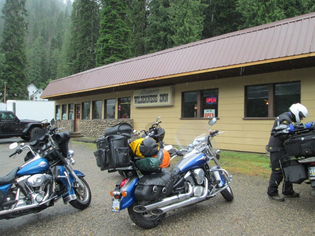
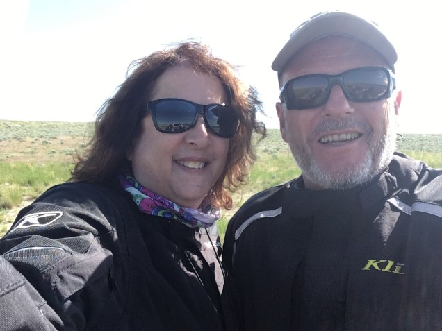
We left Powell, WY at a leisurely pace on the 16th, stopping for breakfast at the Skyline Diner on the main drag. We were plenty different from the locals who were there for Sunday breakfast: our riding gear stood out against the cowboy hats, boots, jeans and western shirts. We looked at the family seated near the door, they looked at us and someone politely said “Good morning!”. We bade them “good morning” in return and all was okay so we took our seats though we remained rather conspicuous. 😀 We had a wonderful breakfast at a reasonable price and were able to listen in on some of the conversations around us. Predictably for a farming community, grain and feed prices, exports, weather and machinery figured prominently, plus a few plans for Fathers Day. It was a great start to the day.

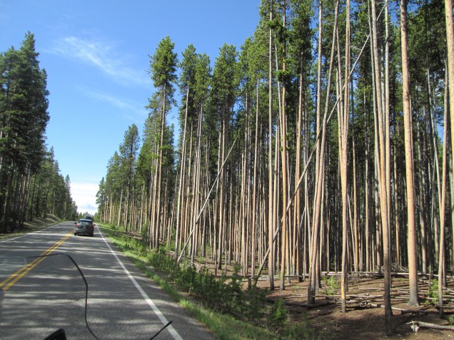
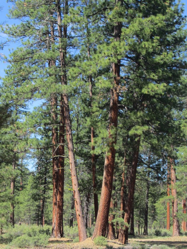
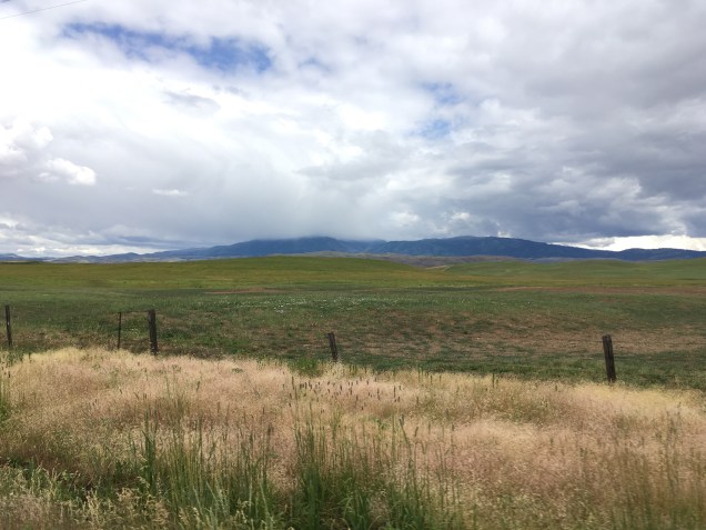
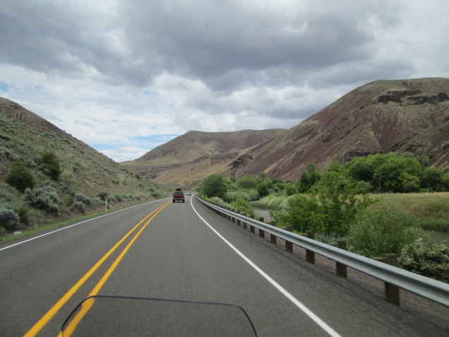
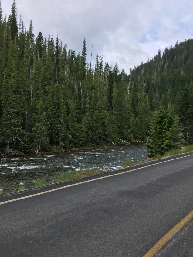
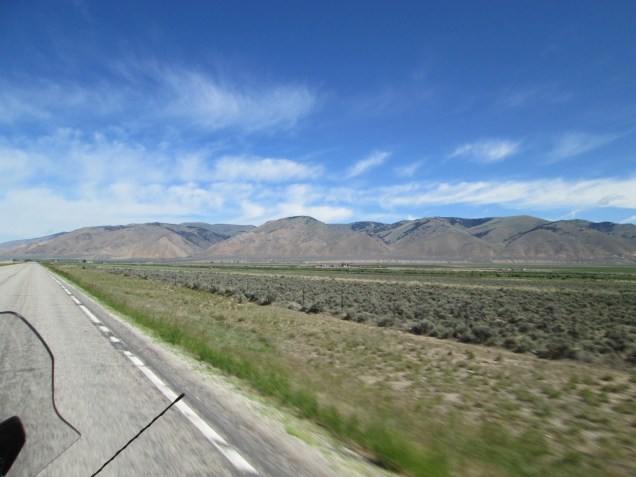
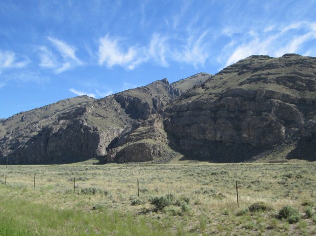
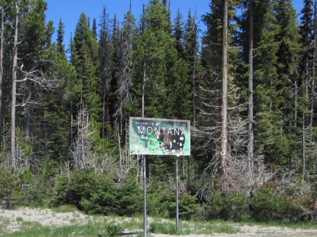
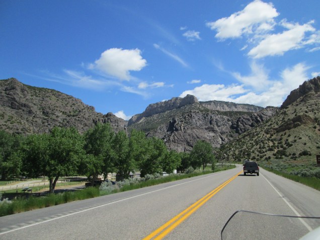
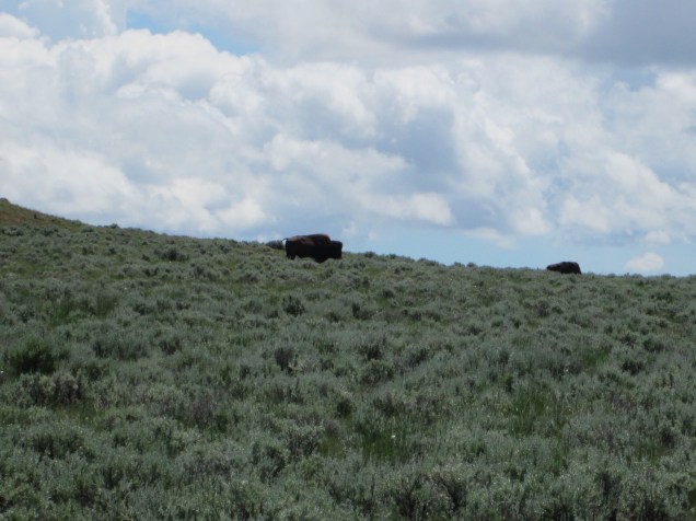
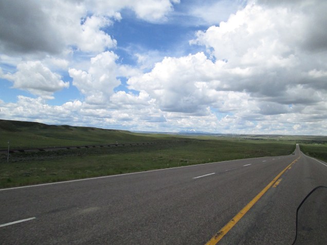
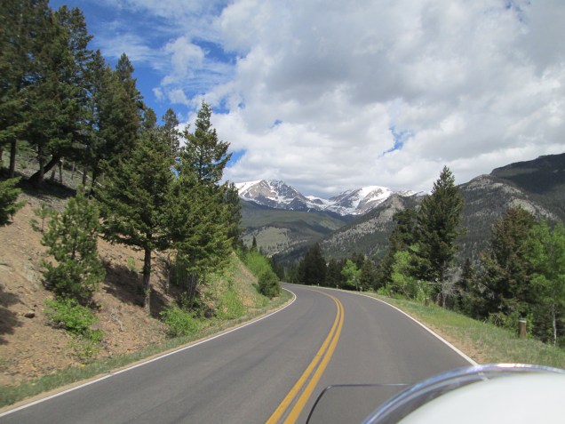
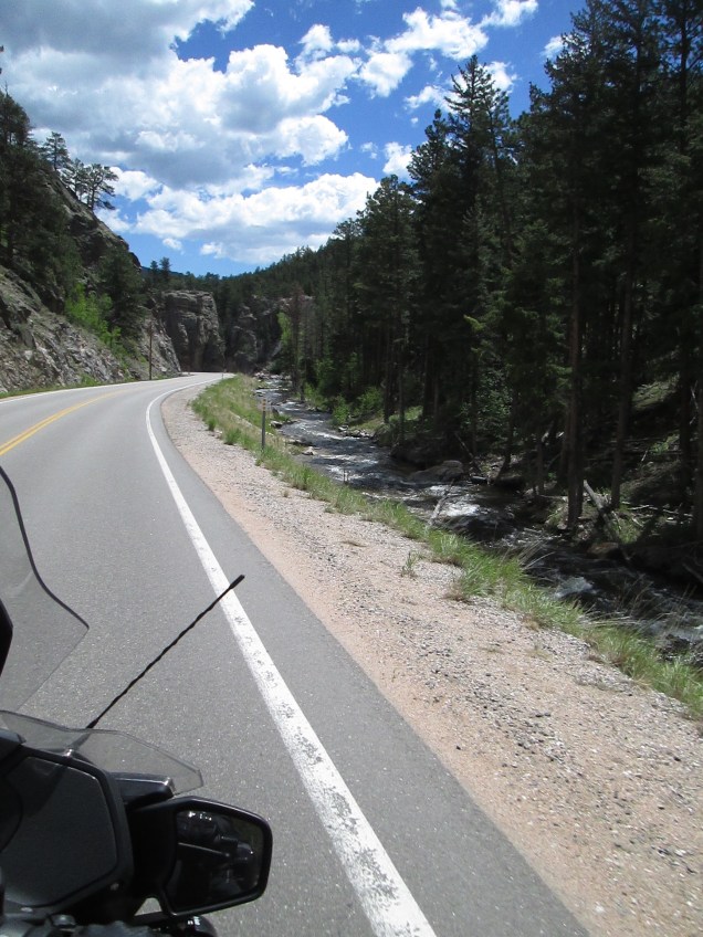
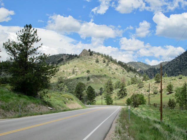
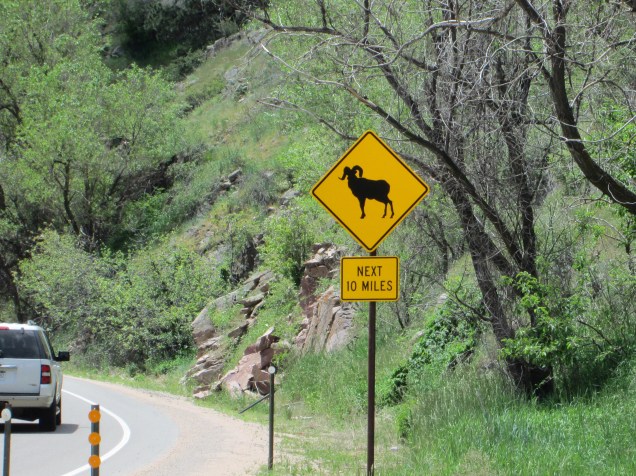
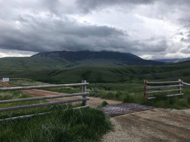
We left Powell heading north toward Red Lodge, MT and the start of the Beartooth Pass Highway (US 212). It was another beautiful, fun ride as we started the climb toward the Beartooth. There was a lot of ranch land, some unfenced, open range. Herds are discouraged from wandering too far along the roadways by “cattle guards”, strips of open steel grid that are painful to cows’ hooves. Though effective, we’re told, we still took our time and kept our eyes peeled; cows are a lot bigger than us.

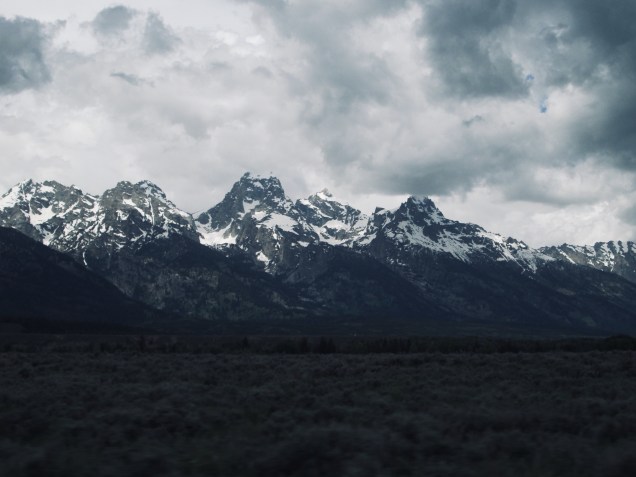
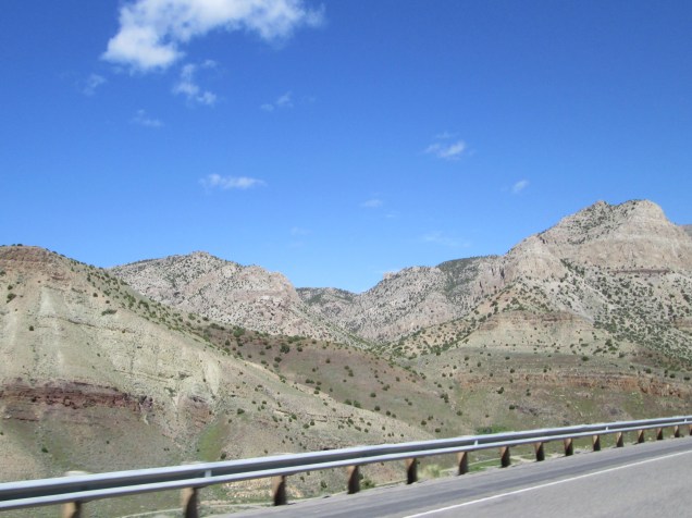
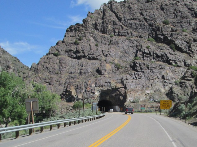
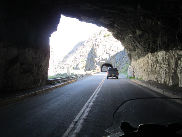
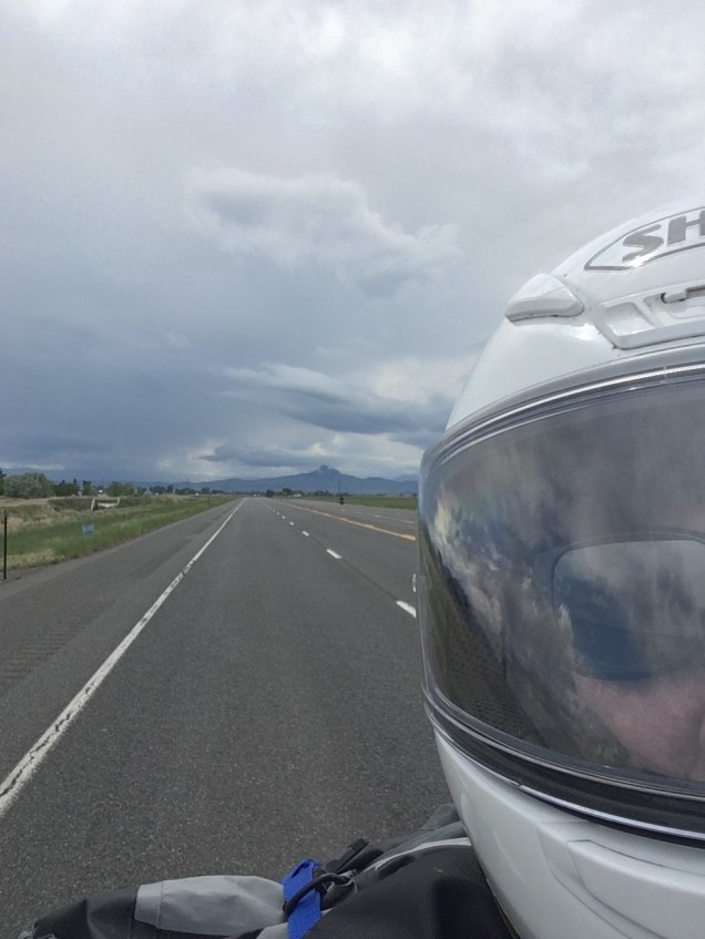
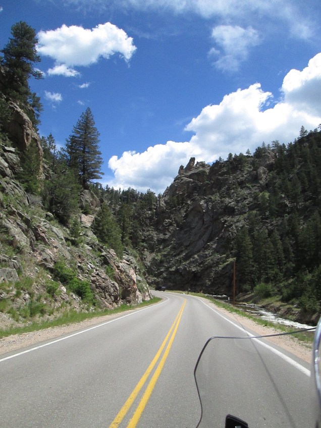
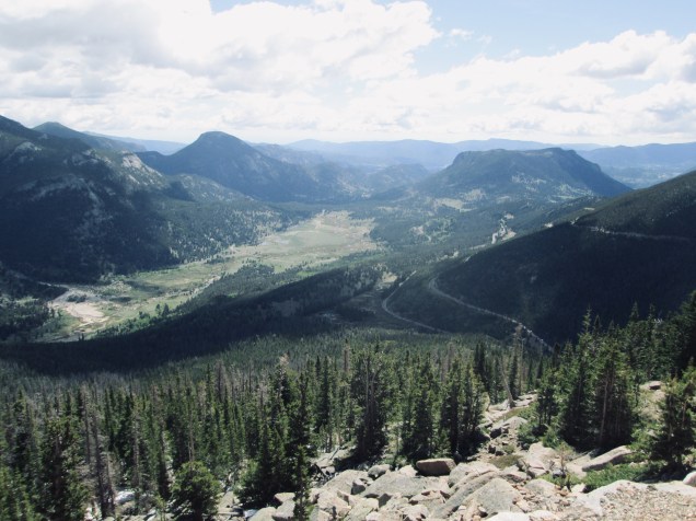
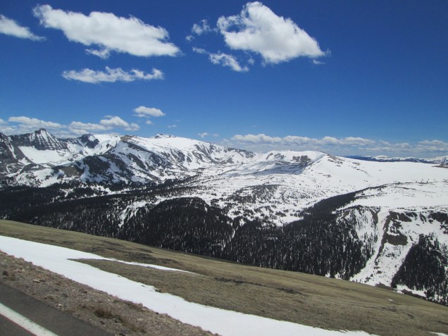
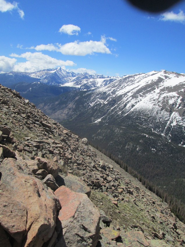
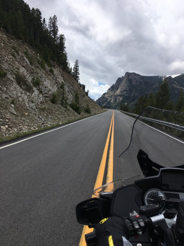
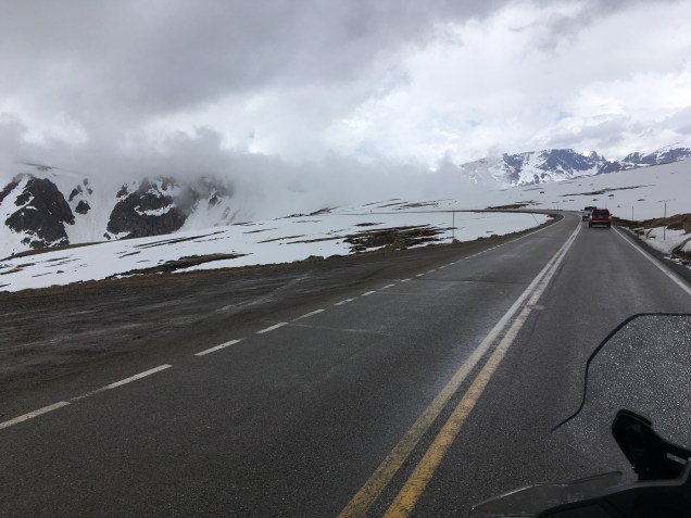
When we got to Red Lodge, the weather started to look unsettled with lots of clouds coming in. So we took a deep breath, put on an extra warm layer, and started the ascent. This is our second ride through the Beartooth Pass, though from east to west, opposite the last time. Lots of twisties, switchbacks, sharp cliffs on the outside and sheer red rock to the inside. There are plenty of pullouts to catch your breath and enjoy the spectacular views and we took advantage. As we climbed toward the top of the pass, a cloud moved in making the air very chill and reducing visibility to not very far. The road surface was good, though, so we made it through fine though it did boost our heart rates. 😀 It was fun!

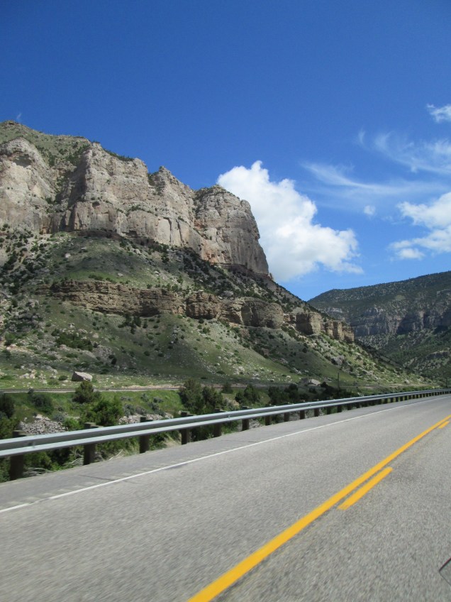
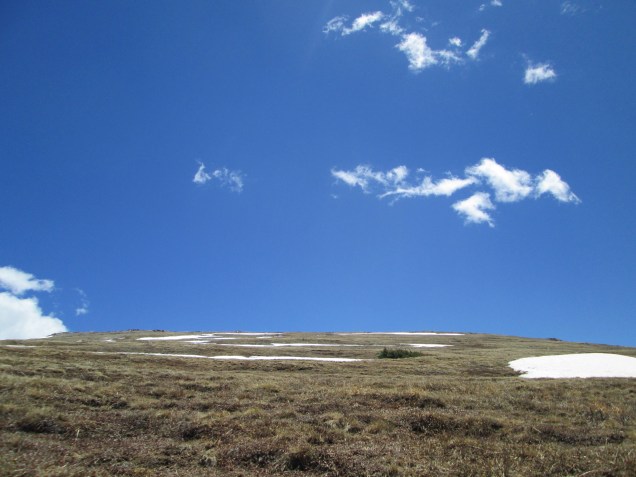
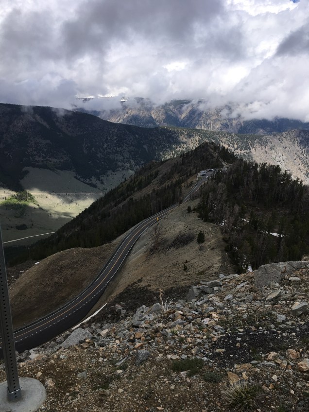
Naturally the sun came out shortly after we reached the top at 11,000 feet. There’s a ski area up there that is still open for business. (Did I mention there are still snow banks taller than our heads along the road?) Snow plowing is serious business out here.

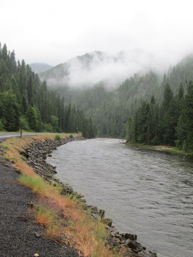
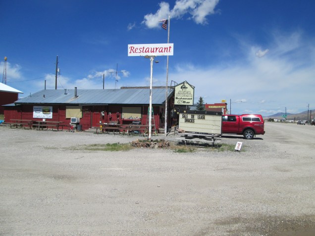
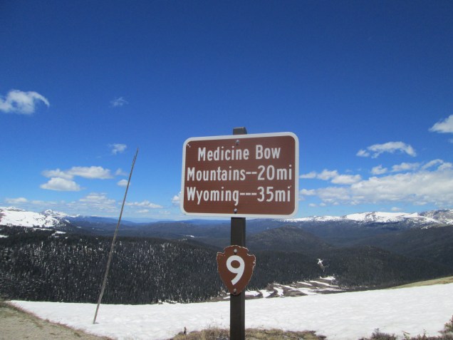
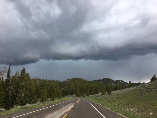
We stopped at a rest area/convenience and souvenir shop called “Top of the World” to rest up and have some coffee. Talked to some fellow bikers and compared notes on the ride – it was fun. But then the sun started to hide again and we resumed our ride down the west side of the Pass. We almost made it before the clouds moved in again. And the rain. We pulled over when the hail started. And the thunder. We were/are very well protected and we’re in no danger. Pea-sized hail makes an entertaining tip-tap sound on your helmet and a stray ricochet finds an inconvenient gap in your collar for a bracing thrill. When the shower tapered off and we made our way to Cooke City for the night’s lodgings. We’d covered about 122 miles but were worn out from the fun.

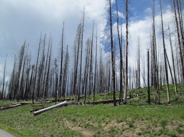
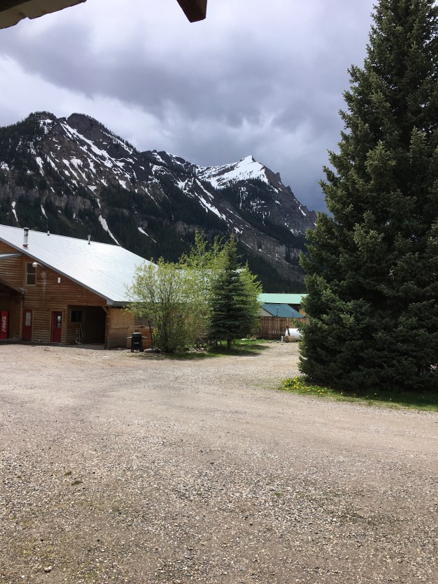
We stayed at a great little motel called the Alpine Inn where the manager, Chad, made us very welcome. Interestingly, Chad is a transplant from the hospitality industry in Atlanta, GA who loves the quiet, the relaxed pace and even the cold of Montana. He’s delighted to become one of 70 permanent residents of Cooke City proper and has taken up snowmobiling as a personal passion. Chad was filled with interesting and intriguing facts about the area. Cooke City is the highest city in Montana and is the only city you cannot get to from Montana – unless you have a snow mobile or heavy duty four wheeler – you have to drive to Cooke City from Wyoming. He pointed out that there was a horrible fire in 1988 that nearly wiped out the moose population in the area. Fortunately, the moose are making a comeback, but it will be another 50-60 years before the numbers approach their former population.

Turns out there’s a bear named Tony and a Fox named Virgil who make their regular rounds through town so we were advised to keep our eyes peeled and doors closed. (Kind of wanted to meet Virgil Fox.). After a good meal of bison burgers and poppy rum cake at the Beartooth Inn, we turned in and slept like babies.

Day 17

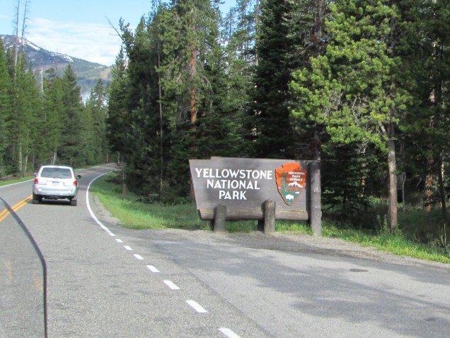
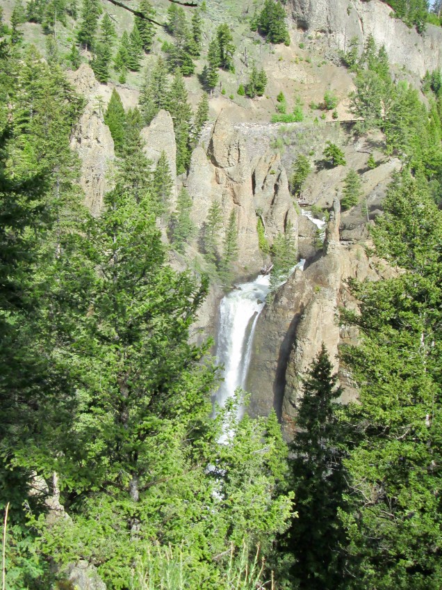
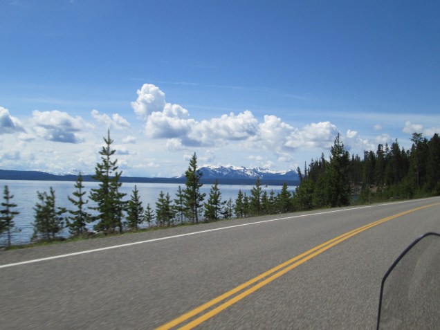
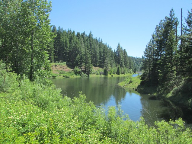
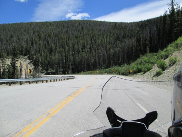
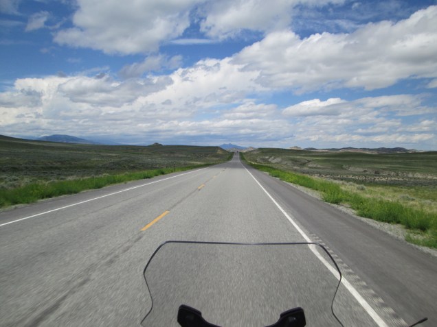
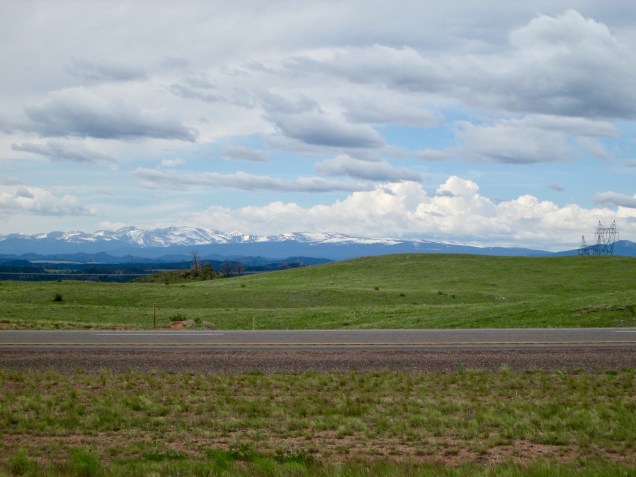
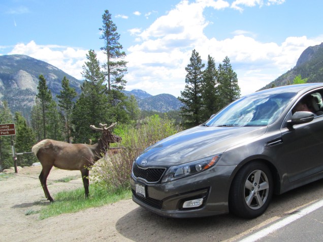
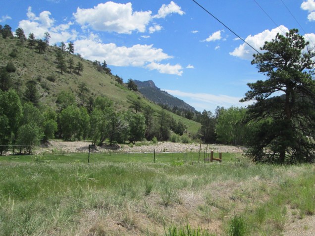
Monday morning we packed up and said a reluctant good-bye to Chad and Cooke City. Did I mention it’s set about by mountain peaks everywhere you look? Our route took us quickly through Silver Gate to the northeast entrance to Yellowstone Nat’l Park. The park is known for its robust geothermal activity and resultant geysers (like Old Faithful), hot springs and pools. Because we toured the park on our last trip, we made stops on our way to the southwest corner of the park and Grand Teton Nat’l Park.

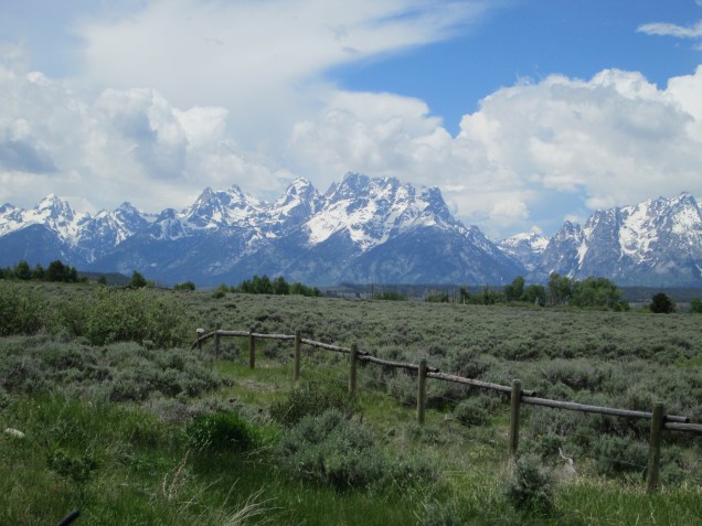
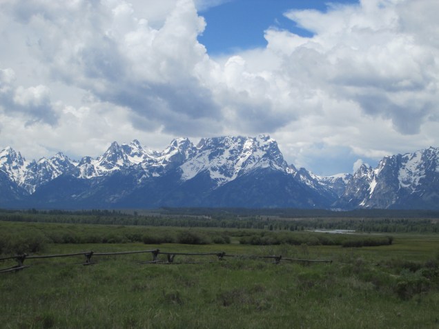
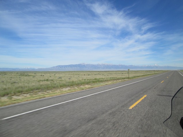
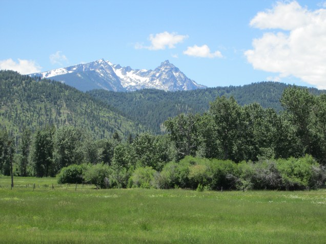
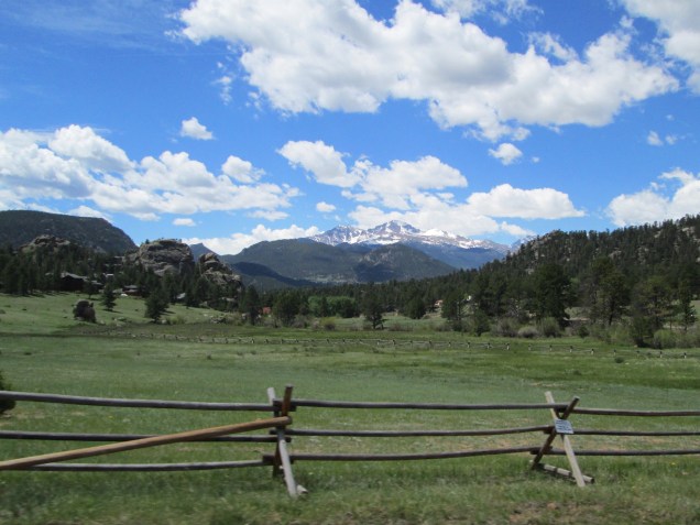
This remains one of my favorite places anywhere in the world. We rode down Rt. 191 on the east side of the range through the Snake River Valley. Connie has some amazing shots, though pictures don’t quite do it. The stark, snow covered peaks are arrayed as imposing sentinels to the land beyond. I find I must stop what I’m doing, still my restless thoughts, and simply watch this vista that fills my heart and mind with awe and thanksgiving.

‘nough said.

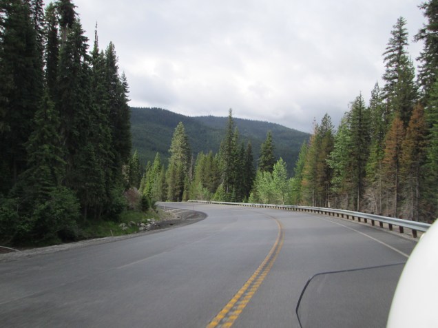
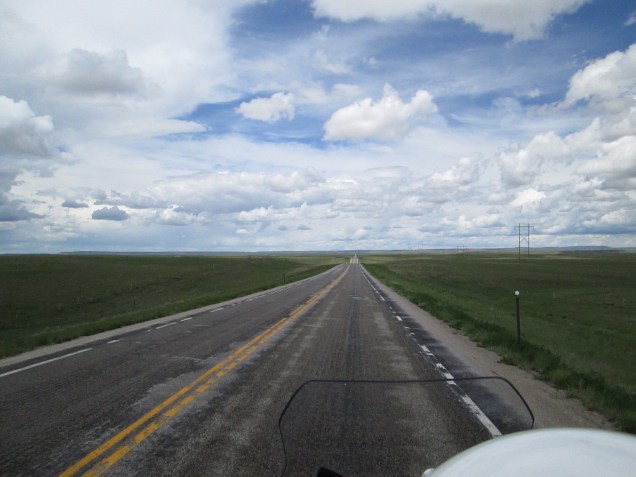
We continued our way down the valley to Jackson, WY, a popular resort town for skiers in winter and park visitors in summer. Lots of shoppes, bistros, casinos, and general trendiness all wrapped in commercial quaintness. Kind of like Six Flags meets Rockefeller Center. We got through as quickly as traffic allowed, and traversed the Teton Pass via WY 22 on our way to Victor, ID for a couple of nights. We met up with two friends we first met on our last trip west, Tom and Hannah, who live in Driggs. Some good food, drinks and great conversation made the day complete. We hope to return their hospitality when they make their way east. A quick stop at the grocery store for essentials and then to our AirBnB where we gratefully collapsed for the night.

Day 18

Today is the 18th and we’re laying low. Doing needful things, like laundry and writing and taking a nap. Nice.

Thanks for your patience, dear readers. Hope you have a wonderful rest of your day.

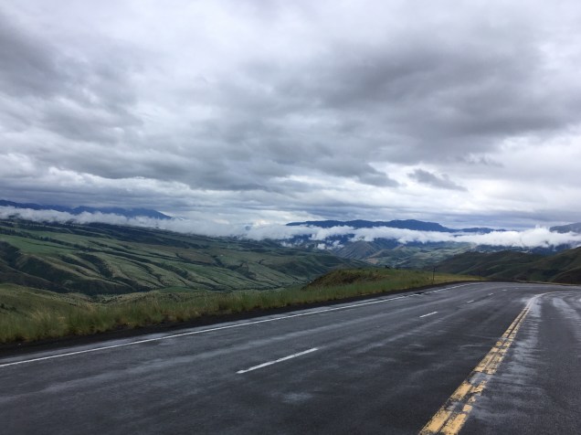
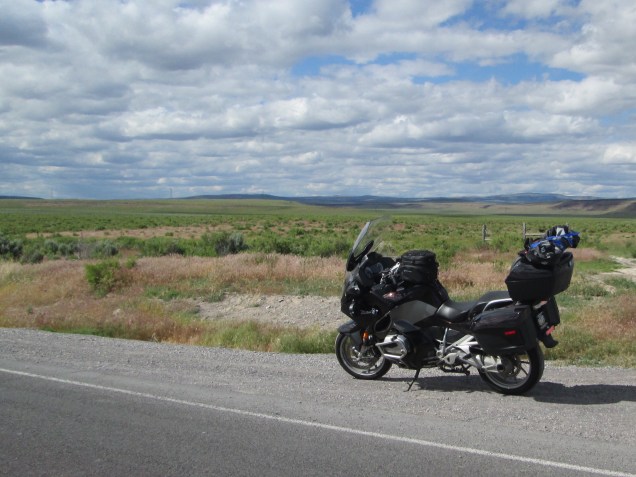
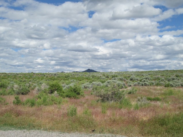
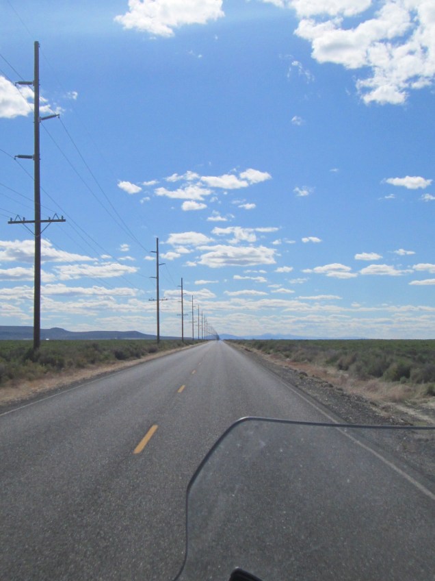
To Cooke City via northwest Wyoming and the Beartooth Pass

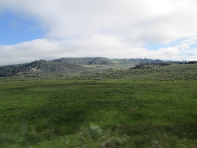
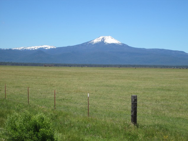
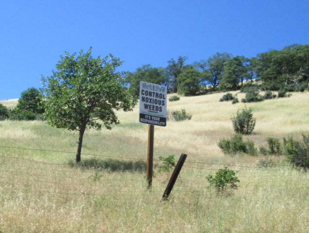
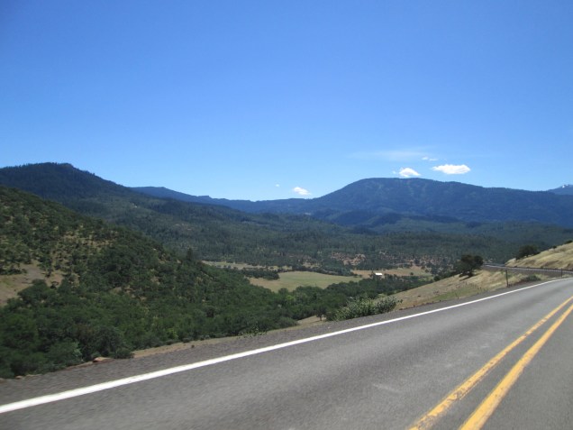
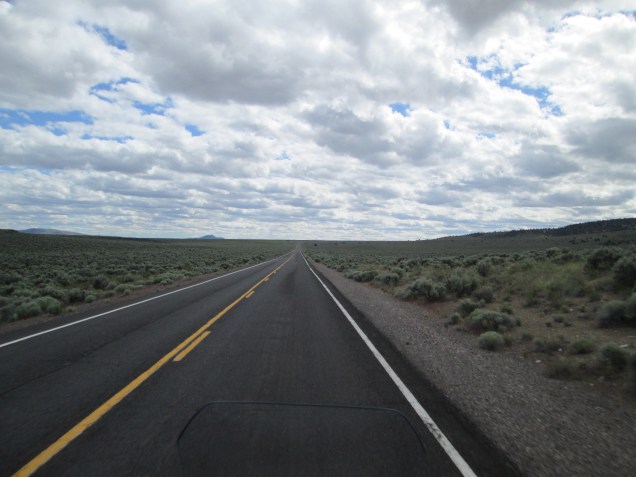
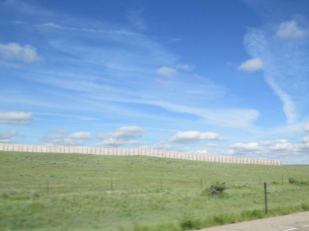
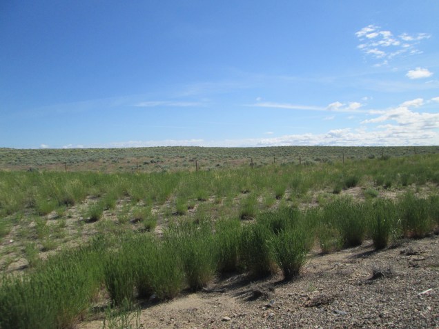
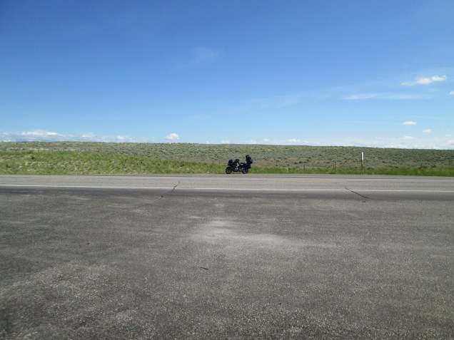
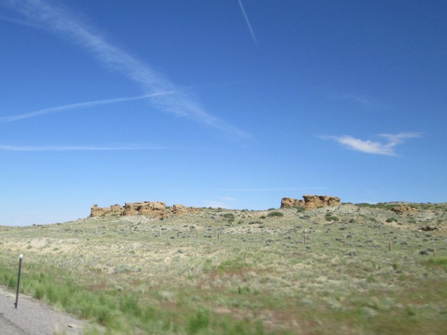
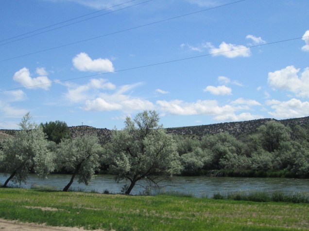
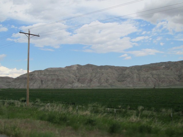
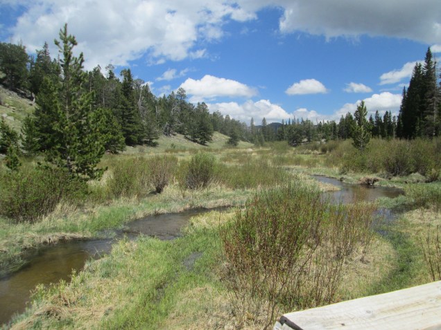
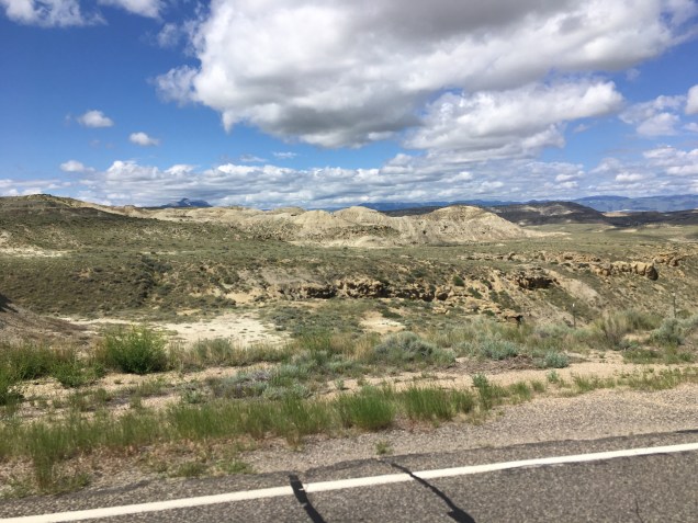
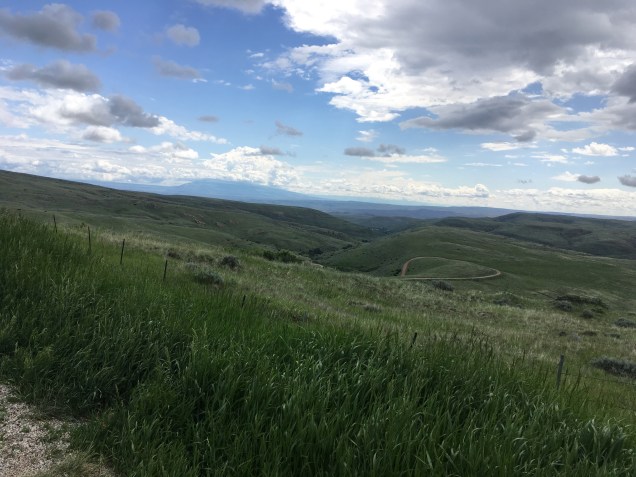
Within the span of one mile, we passed beautiful green irrigated farmland, to a semi arid landscape, to dry, rough terrain. It provides a visual depiction of what the farmers in the area have to work with. Then 20 miles north, we come to lush, verdant and unirrigated landscape. Amazing.

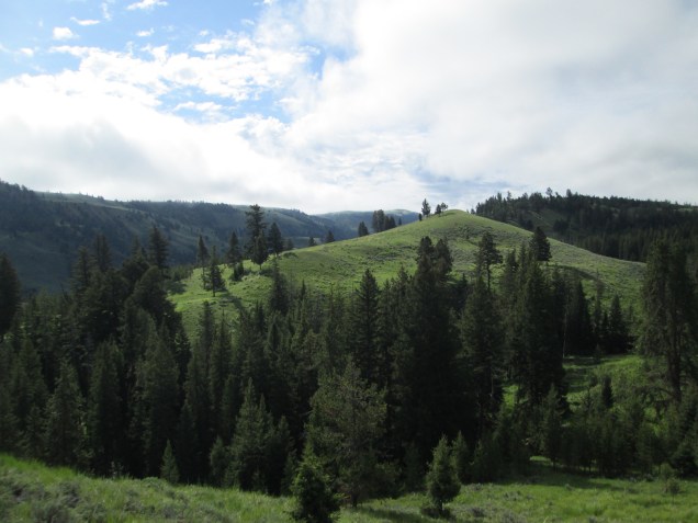
And then to the Beartooth Pass and Cooke City

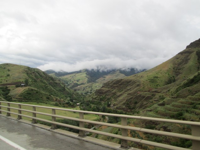
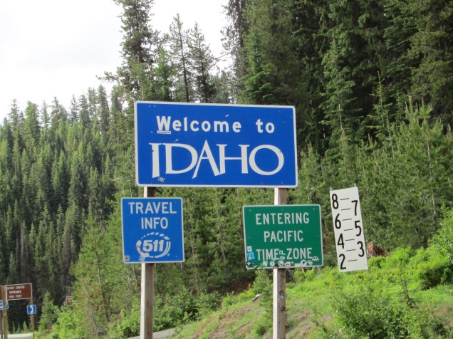
From Cooke City Through Yellowstone and the Grand Teton National Parks to Victor, ID.

It was really hard to choose photos!

Day 15 – June 15

Another happy day on the road. Starting in Casper, we passed 3,000 miles today and wound up in Powell, WY for the evening. On the way out of town at 8:00, we rode by the city rail station and have the answer you and the rest of the free world has been clamoring for … wait for it … Casper, Wyoming has been served by the Burlington Line, which connected with the old Union Pacific and a number of older western rails. If you knew this, award yourself $500 in Monopoly money right away. Knowledge has its rewards! Also on the way out town, we passed a giant eagle sculpture that was beautifully done. Beneath the statue was a placard dedicated to Kelly Timberman, who in 2004 won the title of World Champion Bareback Rider. He is still a successful rodeo rider on the professional circuits.

Coming north on US 20/26, we processed (in a stately manner, of course!) through some beautiful country, including the narrow Wind River gorge that took us down several thousand feet in elevation over about 25 miles. The road and rail line descended on opposite side of the river, and both road beds passed through tunnels cut through living rock. It was fun!

Several lovely Wyoming towns including, Shoshoni, a town of 652 near the Boysen Reservoir where US 20 splits from US 26; then Thermopolis, (“Hot City”), a town of about 3,000 folks that contains Hot Springs State Park with thermal baths and a lovely range with a herd of bison. We met a lovely couple from Winnipeg who appeared to be on their honeymoon and were loving the Wyoming countryside. They also helped us get “unlost”from among the bison.

We’d also met Jay, an engineer from near New Haven, CT who was riding his new BMW motorcycle home from a dealer near Yellowstone. We later rode by his parked bike outside the thermal baths. They are quite luxurious, we are told, and he clearly wanted to enjoy them before continuing on his way.

Our next route, WY 120 took us toward Yellowstone and through the town of Meeteetse, population 352 and then on to Cody, home to several museums dedicated to Wild Bill Cody of western frontier fame. Racing along Alt. US 14, we beat several big storms to make it safely to our lodgings. We even had time to pick up some supper (salad kit plus some protein) and adult beverage to make the evening comfortable.

We found the countryside breathtaking and the people we’ve met are so generous and welcoming. We are so enjoying our trip through this state.

We reached a milestone today, passing 3,000 miles on the trip. Our backsides are now road conditioned and we can go for extended periods without whining or complaint. We’re so proud.

Tomorrow, we’re headed to repeat a ride we so loved on our last trip: the Beartooth Highway on US 212 that starts (for us) in northwest Wyoming and reaches 68 miles into northeast Montana and the entrance to Yellowstone National Park. The road cuts through the Beartooth Mountain range of the Rockies and reaches 11,000 feet at the pass. We’re told the road is clear of snow and open for riding.

Our destination tomorrow will be Cooke City, MT where, unfortunately, there will be no digital service. So our next update probably won’t be until we reach Victor, ID on Monday.

Until then, thanks for keeping us company on our trip. Be well!

Casper

Leaving Casper and our view for a long long time

Wind River Canyon. Oh wow.

We found ourselves lost in a park

Scene changes on the way in and our of Cody and running from the storms

Day 14 – June 14

On what started as a beautiful travel day, we rode 268 miles from Estes Park, CO to Casper, Wyoming. We had great weather as we left Colorado on Rte. 34 toward Ft. Collins, winding through gorgeous canyons and gorges. Lots of twisties and elevation changes to make the ride exciting, if a bit slow. North of Ft. Collins, the road opened up on US Rte. 287 toward Laramie, Wyoming, home to the University of Wyoming. The name Laramie encourages romantic images of old Westerns from long ago. (I’m thinking of Shane in particular.). Our route took us through Medicine Bow, home to 267 souls and named after the Medicine Bow River. It boasts the Virginian Hotel, setting for the TV show that starred James Drury. It was lunchtime so we stopped in. The hotel was built in 1911 and is beautifully maintained. The proprietors make the most of the connection to the TV show and the book, The Virginian, by Owen Wister (copies available at the restaurant counter, of course). And the food is excellent!

We headed up WY Rte 487 through some pretty if underpopulated land. We passed maybe 8 cars in an hour, though there were a fair number of cattle out to graze. The land feels very open with rolling hills and gullies, and even some buttes to add variety. What we noticed was the immense sky that can make you feel so very small. The land we passed through was beautiful and seemed to go on forever.

We arrived at last in Casper, second largest city in Wyoming with 55,000 people and checked into our motel. Tomorrow we head toward Powell, WY in the northwest corner of the state.

BTW – what was the principal railroad that has served Casper? Someone has to know. 😀

That’s all, folks!

The landscape changed quickly as we left Rocky Mountain National Park

Wyoming landscape is just entrancing even though the roads can be quite straight.

The Virginian Hotel and Cafe

Day 13 – June 13

Today was an easy, low key day. We slept late (a leisurely 8:30) after watching Game 7 of the Stanley Cup Finals last night and lounged some, did some laundry, took a short jaunt through Devils Gulch and lounged some more. Our excuse is that we need to rest up for some strenuous days immediately ahead. Truth is, we also just felt like a break. And then there’s the hot tub.

Connie has some nice shots of our ride through an arid area carved from volcanic rock ejected some 40 million years ago. No snow today because we weren’t high enough, but lovely streams and a number of obliging elk who stepped forward to promote the Nat’l Park. Our ride lasted just 45 miles, which brings us to 2,700 miles overall!

A note about our hosts. Tom and Janet are the proprietors of this airBnB and they are so kind and obliging. They have made us feel like family and we are so fortunate to have met them. If you ever plan to visit Estes Park, CO and Rocky Mountain National Park, give us a shout and we’ll gladly share their contact information.

That’s about all for today. On the road for Casper, Wyoming tomorrow. For Rail Baron players, which railroad serves Casper? Double points if you don’t look. 😀

Have a great night!

Our short cruise through RMCP on our way to Devil’s Gulch this for morning.

Devil’s Gulch

Why we ride! Twisties!

How sweet!

A last evening view from our Air BnB

Day 12 – June 12

Today was all about Rocky Mountain National Park. It was established in 1915 by act of Congress due, in large part, to the advocacy of Enos Mills, a naturist and guide; and Mary King Sherman, an active resident of Estes Park, CO. Any number of companies and commercial concerns wanted the park to be designated a National Forest, under the administration of the US Forestry Service, which would allow mining and liberal logging for profit. The National Park designation, however, preserves the land in perpetuity so that future generations will have access to enjoy and learn in these pristine lands.

Native Americans were here long before all others. There have been some finds of ancient tools, pottery and rock construction that point to their early presence, as long as 10,000 or more years ago. More recently the Ute, Cheyenne and Arapaho people hunted seasonally here. Their movements may have worn the trail now known as the Trail Ridge Road (TRR), a stunningly impressive road that traverses the park roughly from east to west.

The TRR is often steep, sharply curved and climbs through distinctive kinds of terrain: from lush, wet forested land below 9,000 feet, to snowy land with spruce and fir trees up to 11,400 feet, to frozen tundra above the tree line up to 14,000 feet. The road climbs to just over 12,000 feet, but you really get the feel for the differences in each type of land.

The going is slow and careful all along the 2-lane Trail Ridge Road, which explains why we covered only 85 miles in a over 5 hours. Seriously. Yet we wish it had taken us longer because there is so much there. There are plenty of turnouts and scenic overlooks where you can get off your seat and see the earth in its glory. At one overlook, for example, we were able to see a range of the Rockies called the Never Summer Range bout 20 miles away, and the Rockies that extend into Wyoming 35 miles north, all of which is true wilderness.

We saw some elk soon after arriving in the park – truly impressive animals who are bigger than you might imagine. Then there were the marmots, essentially large ground dwelling squirrels who inhabit the tundra above 11,400 feet. Relatives of groundhogs, they do all their active business in the 4 months of relative warmth from June to September, then hibernate the other 8 months because, frankly, it is brutally cold up there. While they’re out and about, they are foraging like crazy, and reproducing of course, and totally unconcerned about humans or much of anything else. Very cute, they are.

Just a note: the road can seem a little hairy at times. There are switchbacks and other tight corners, and sometimes there are no guardrails along the way. But a reasonable speed (slow!) and full attention will get you through in good shape. What I’m saying is that it’s not really difficult driving, and the experience is fully worth it. Don’t be afraid if you ever have the chance.

That’s all for tonight. More tomorrow.

Well Hello!

The Tundra and Yellow Bellied Marmots on Trail Ridge Road

Looking down at the tree line from the tundra.

Beautiful vistas. Way out in the distance is the Never Summer mountain range.

A short walk into some wetlands to finish our day.